Home
|
Contact
Home
Competition
Grand Tours
Gallery
Contact
home
|
grand tours
|
stages
stages details
Vuelta a España 2026
Tour de France 2026
Giro d’Italia 2026
Vuelta a España 2025
Tour de France 2025
Giro d’Italia 2025
Vuelta a España 2024
Tour de France 2024
Giro d’Italia 2024
Vuelta a España 2023
Tour de France 2023
Giro d’Italia 2023
Vuelta a España 2022
Tour de France 2022
Giro d’Italia 2022
Vuelta a España 2021
Tour de France 2021
Giro d’Italia 2021
Vuelta a España 2020
Giro d’Italia 2020
Tour de France 2020
Vuelta a España 2019
Tour de France 2019
Giro d’Italia 2019
Vuelta a España 2018
Tour de France 2018
Giro d’Italia 2018
Vuelta a España 2017
Tour de France 2017
Giro d’Italia 2017
Vuelta a España 2016
Tour de France 2016
Giro d’Italia 2016
Vuelta a España 2015
Tour de France 2015
Giro d’Italia 2015
Giro d´Italia 2020
103. Giro d´Italia
Oct. 3rd to Oct. 25th 2020
total kilometer
3358.9
total vertical meters
52825
43935 Δ 8890
Ø stage severity © STS
15.7
13.1
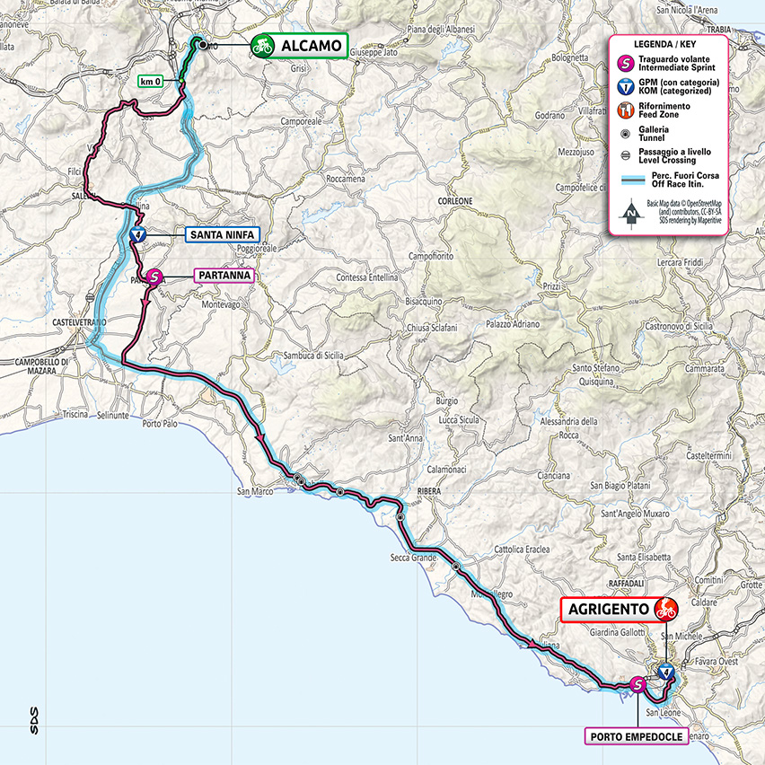
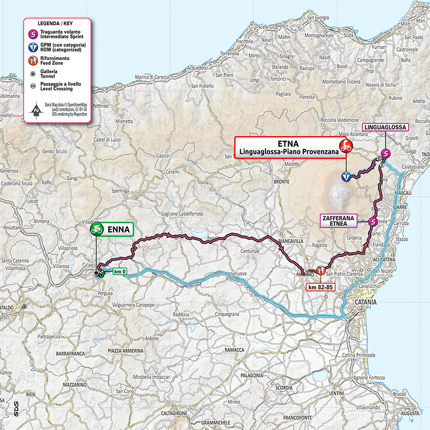
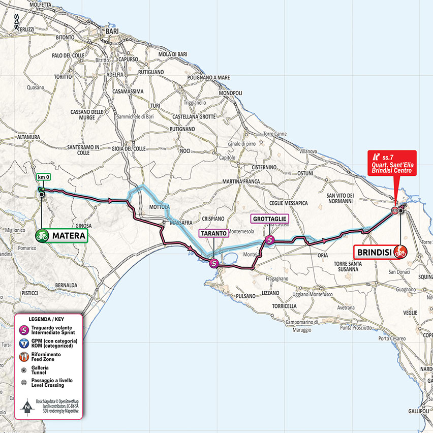
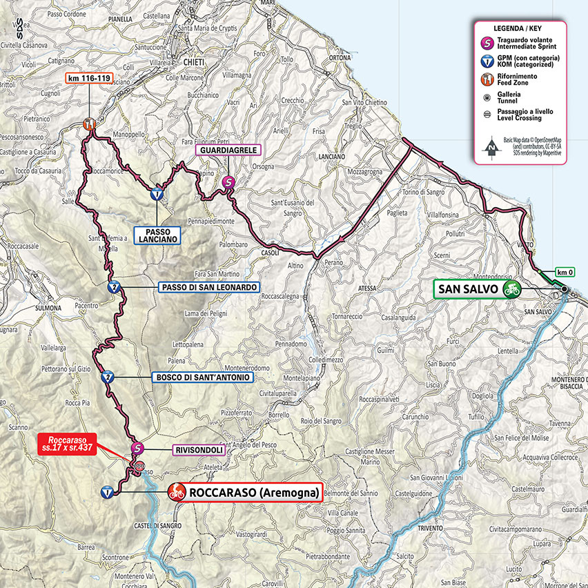
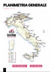
Map overview
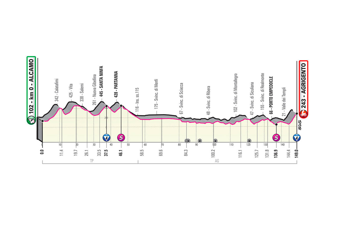
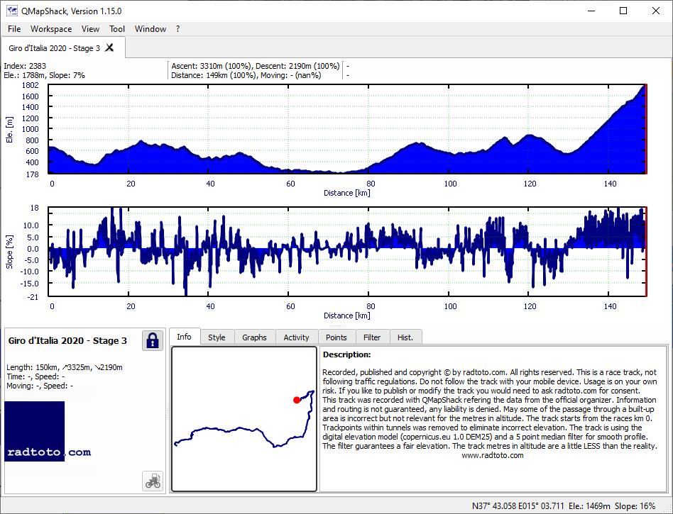
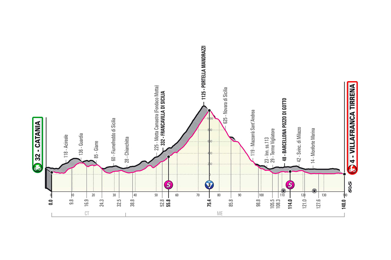
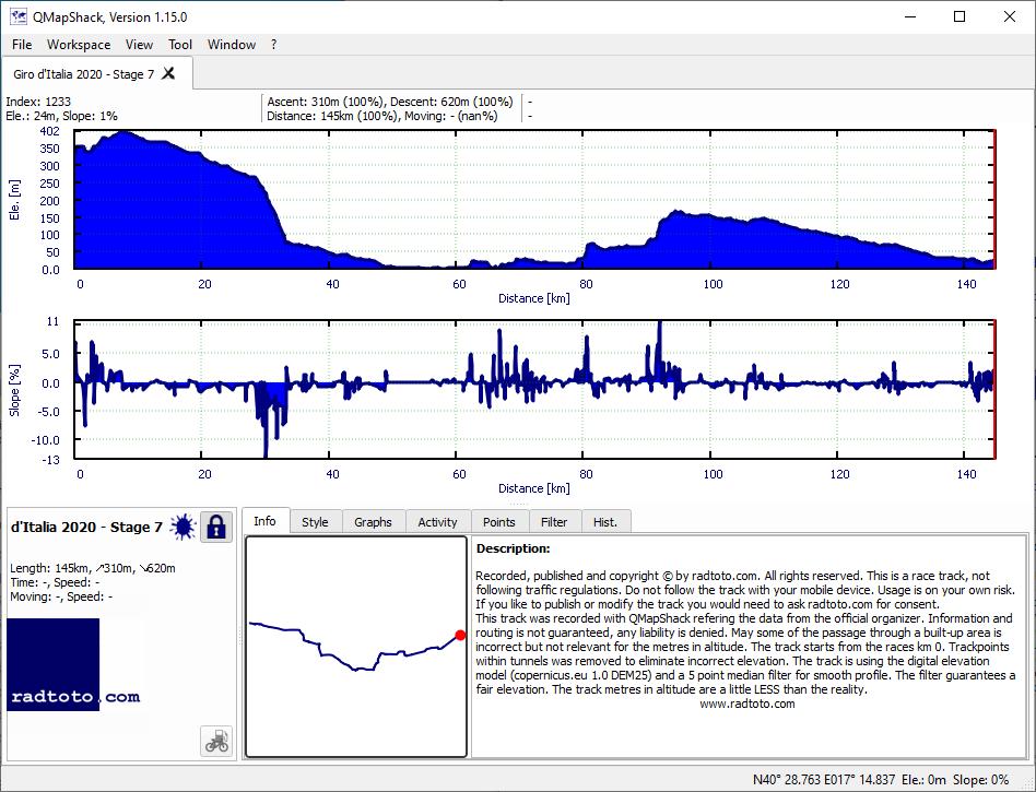
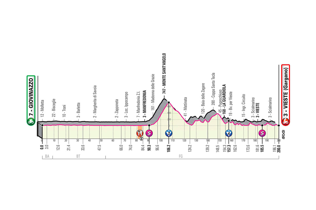
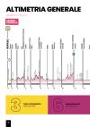
Profile overview
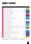
stages
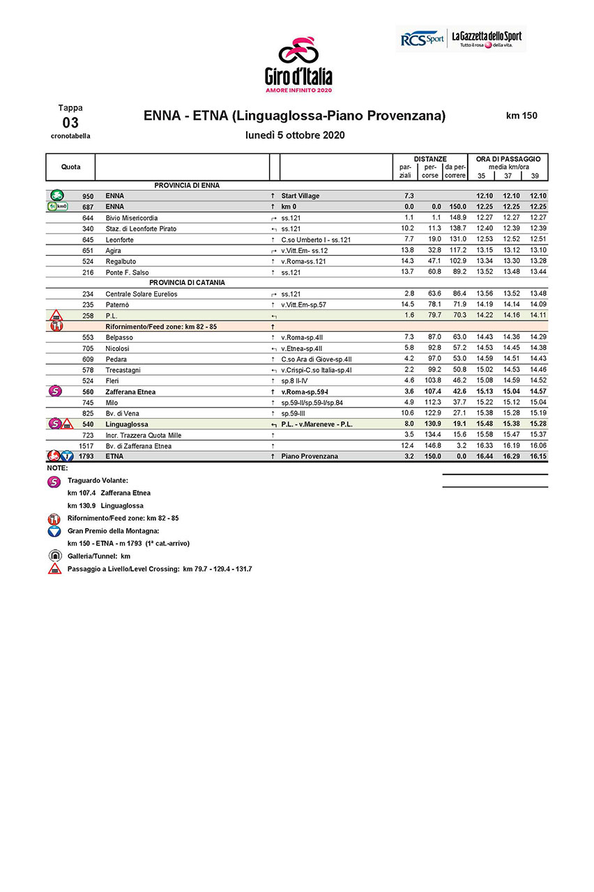
roadbook (51 MB)
The stage severity (STS) is the vertical meters per kilometer of a stage [= vertical meters / kilometer]. The colors from green = flat, to red = steep, indicates the difficulty of the stage.
winner
85:40:21 - 39.2 km/h
- 01:32
t/km
last
+6:13:59 - 36.5 km/h
- 01:39
t/km
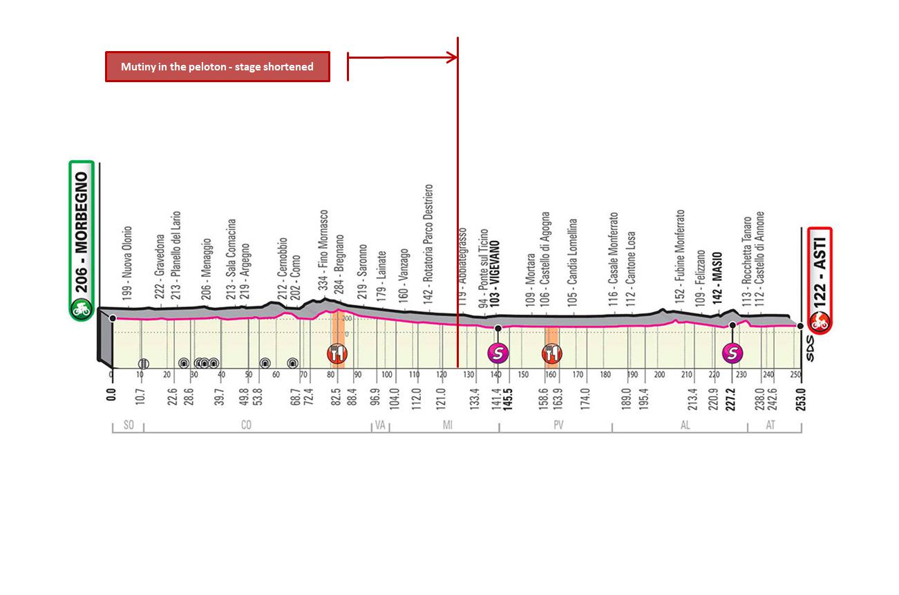
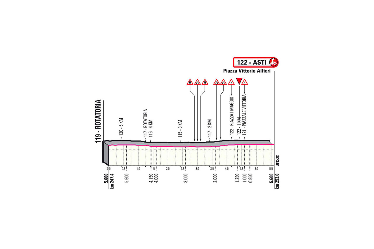
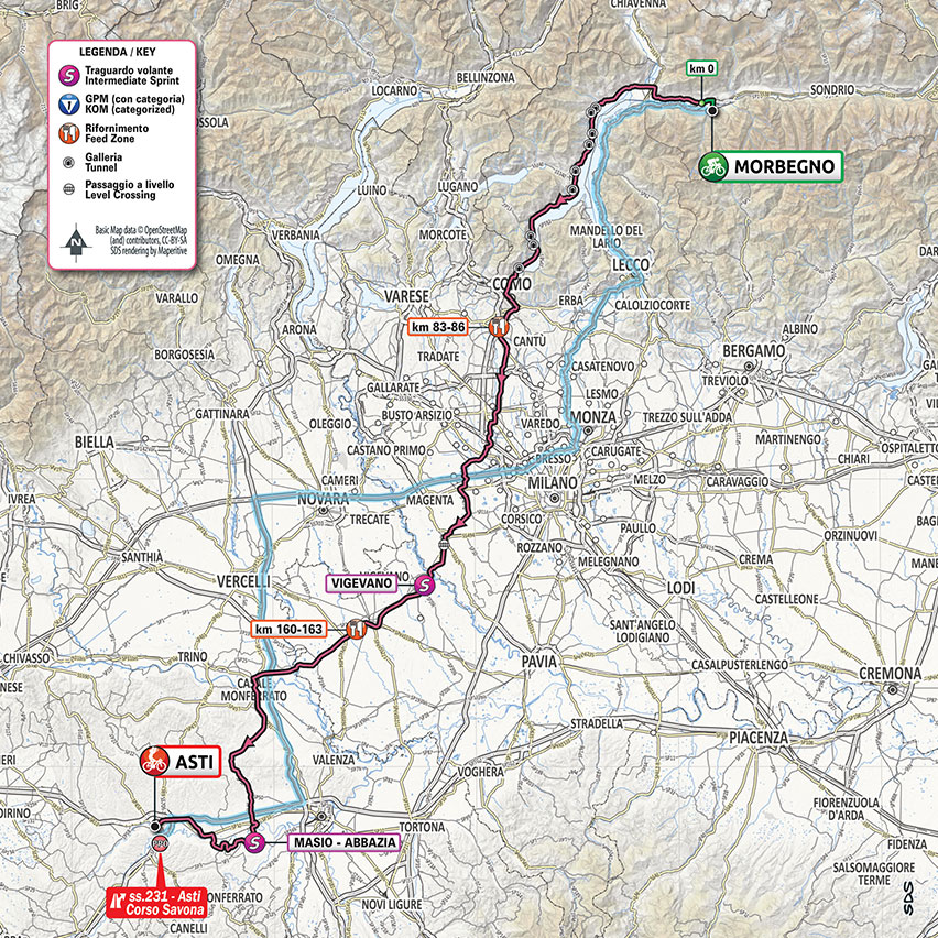
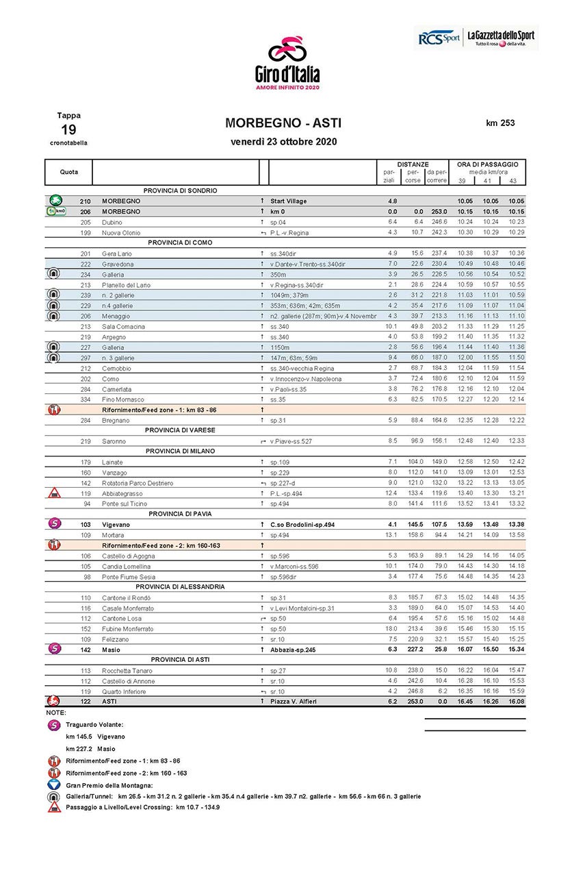
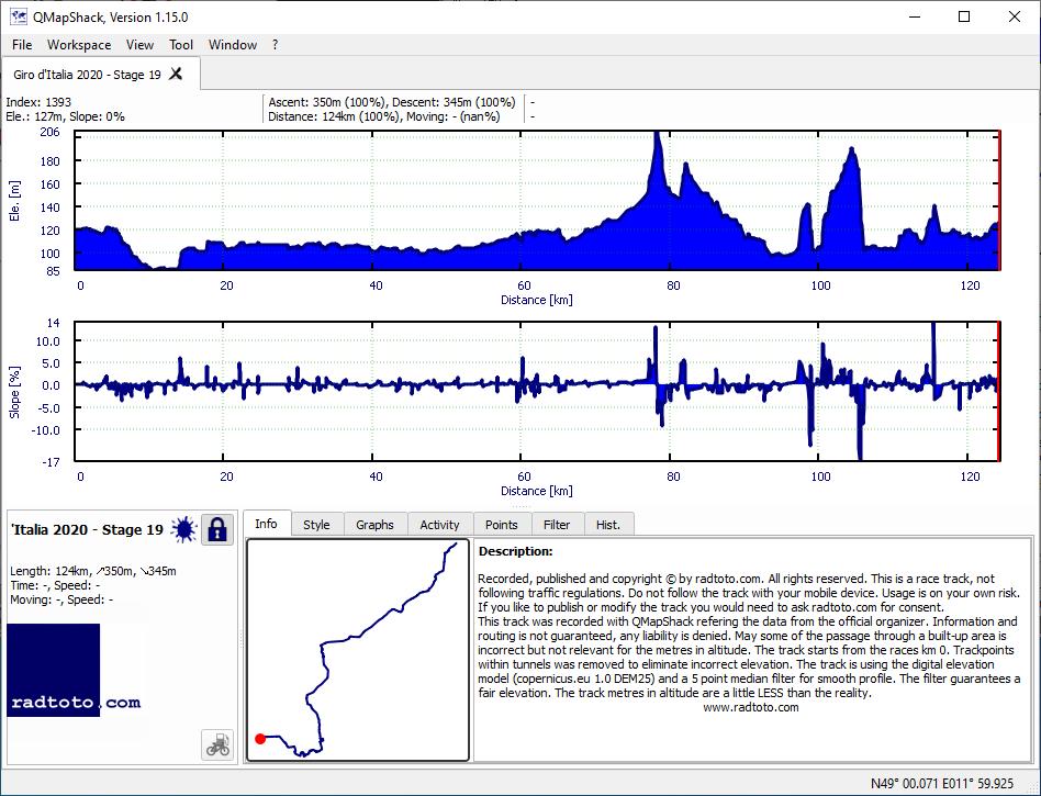
19th stage, Mutiny in the peloton - stage 19 shortened to 124km after rider raising concerns over 258km length. Original stage was 258km long, 1160ma uphill, 1250ma downhill.
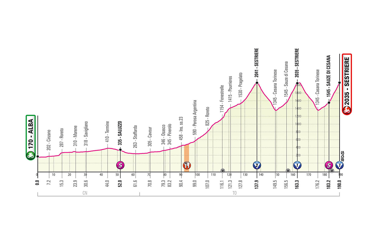
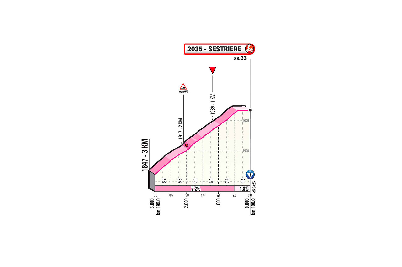
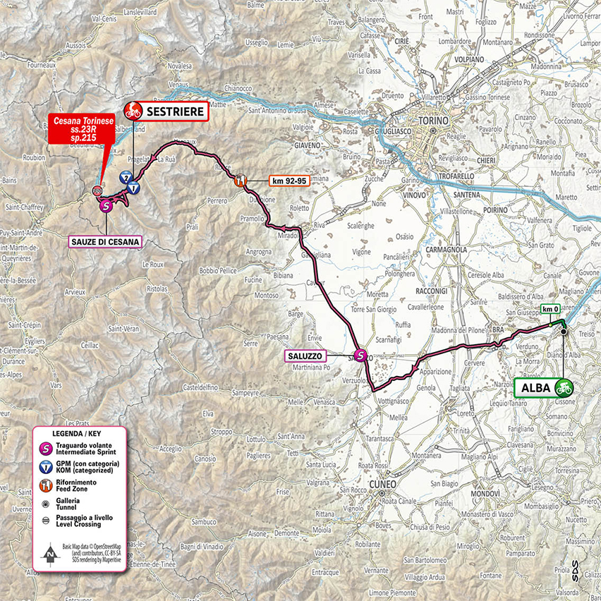
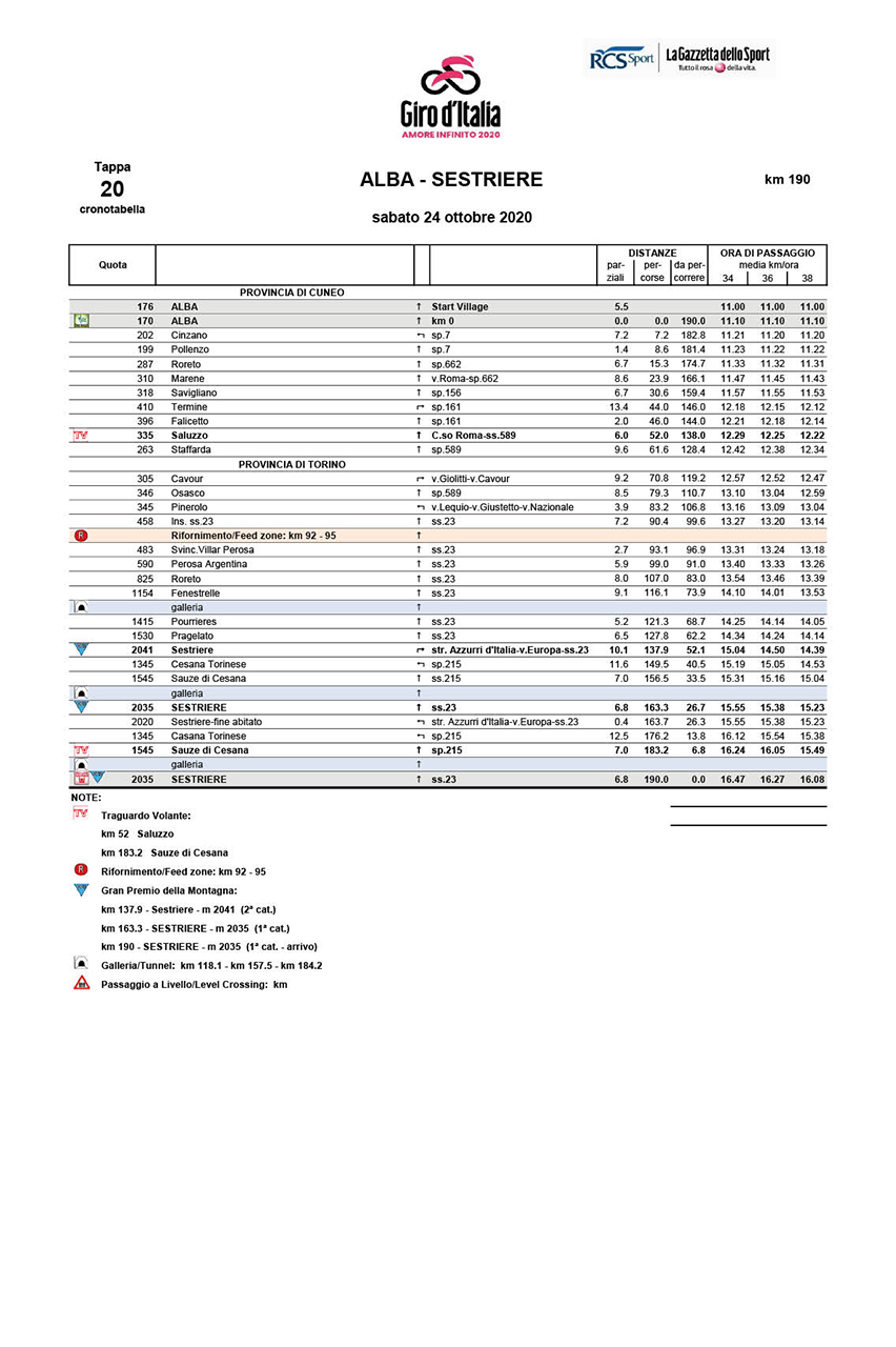
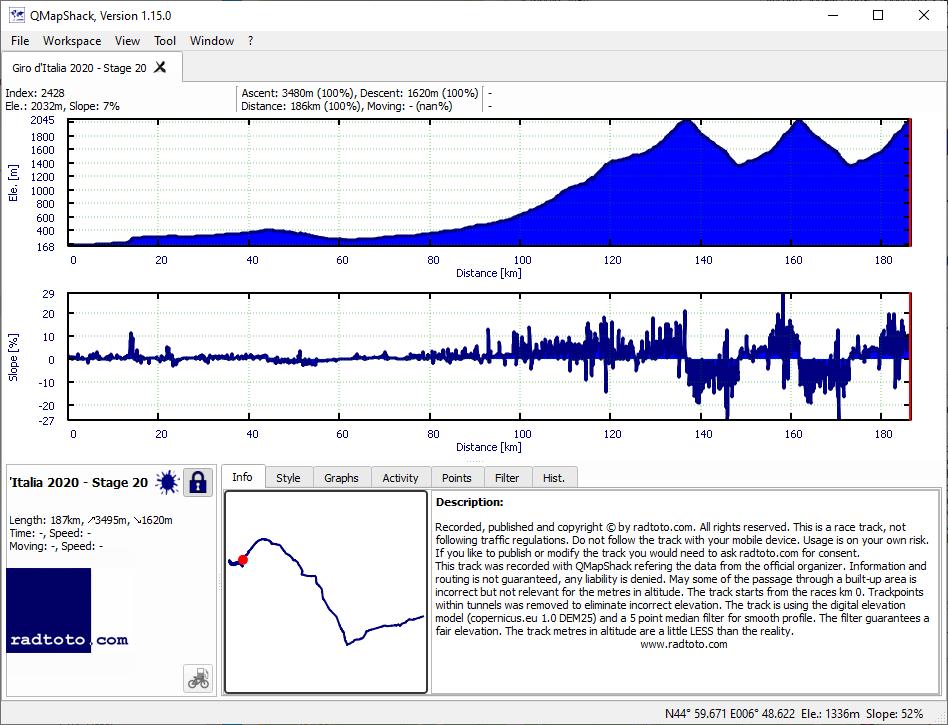
20th stage, COVID-19 restrictions in France have forced the organisers of the Giro d'Italia to massively change the final mountain stage to Sestriere. The race will no longer climb the 2744m-high Colle dell'Agnello and cross into France for the Col d'Izoard, instead climbing to Sestriere three times. Original stage was 198km long, 5265ma uphill, 3390ma downhill.
All the data on this page were adjusted to the effective route taken
№
date
km
vm
Δ
STS
category
P
L
M
IT
RP
GPS
winner
h:mm:ss
last
[m]:ss
km/h
t/km
m:ss
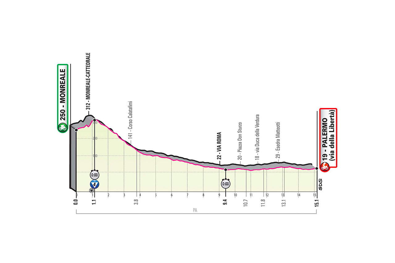
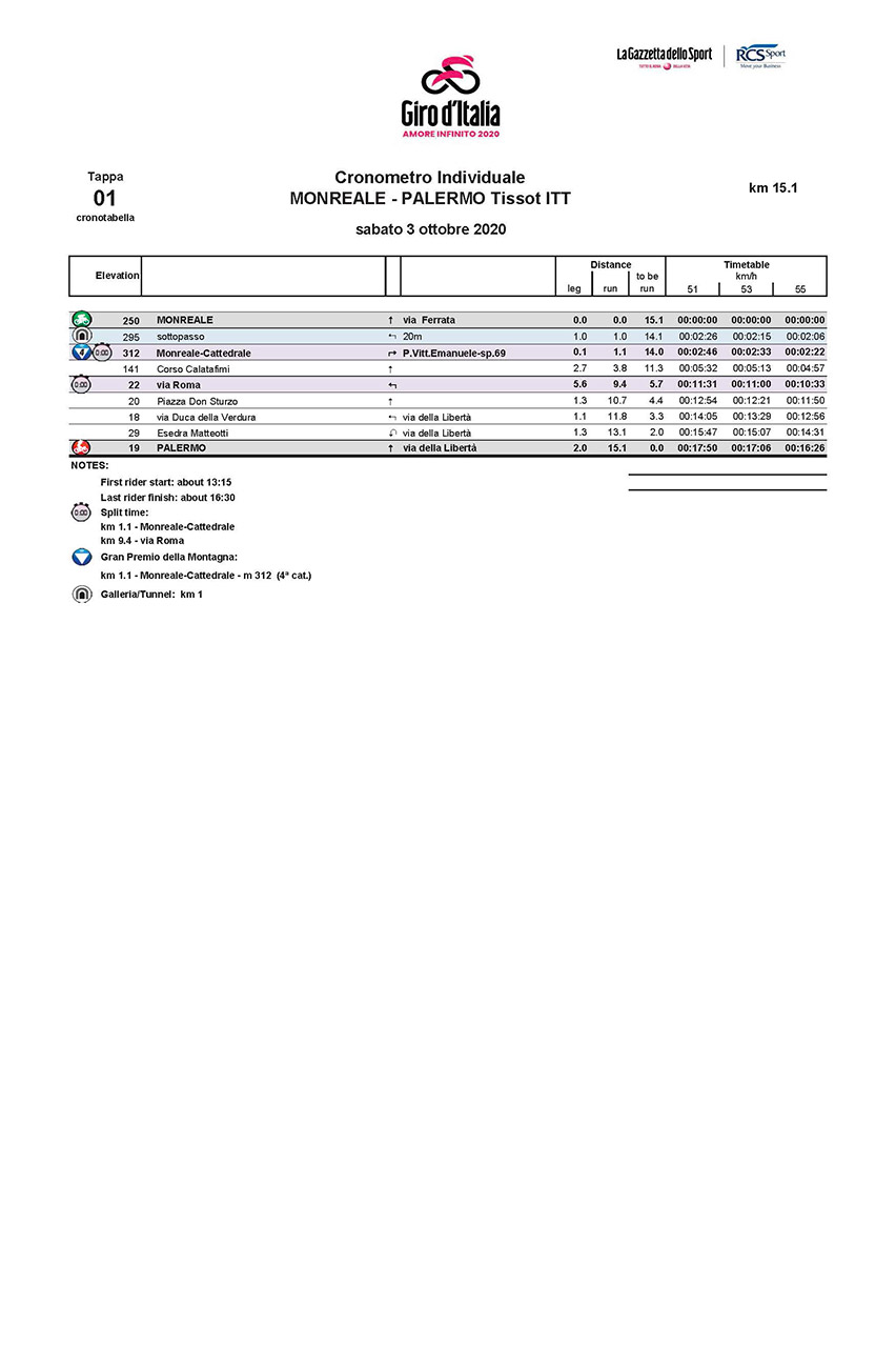
1
Sa.
3.
Oct
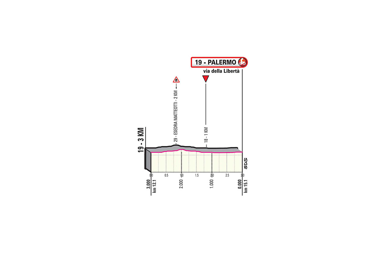
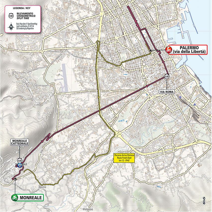
15.1
75
305
5.0
20.2
ITT-4
gpx
00:15:24
+4:00
58.8 46.7
1:01 1:17
2
Su.
4.
Oct
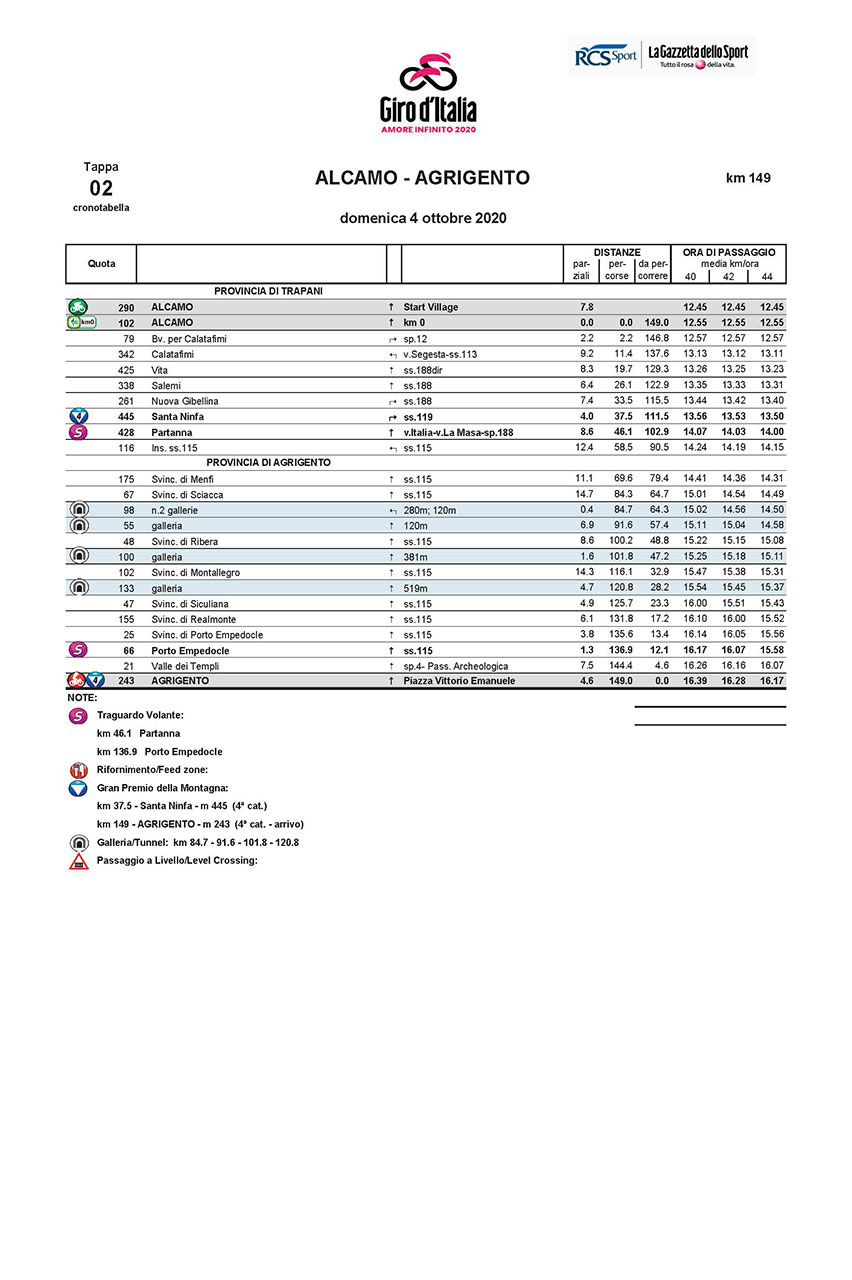
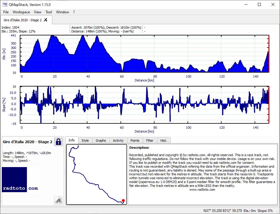
149.0
1975
1810
13.3
12.1
4-4
gpx
03:24:58
+16:39
43.6 40.3
1:23 1:29
3
Mo.
5.
Oct
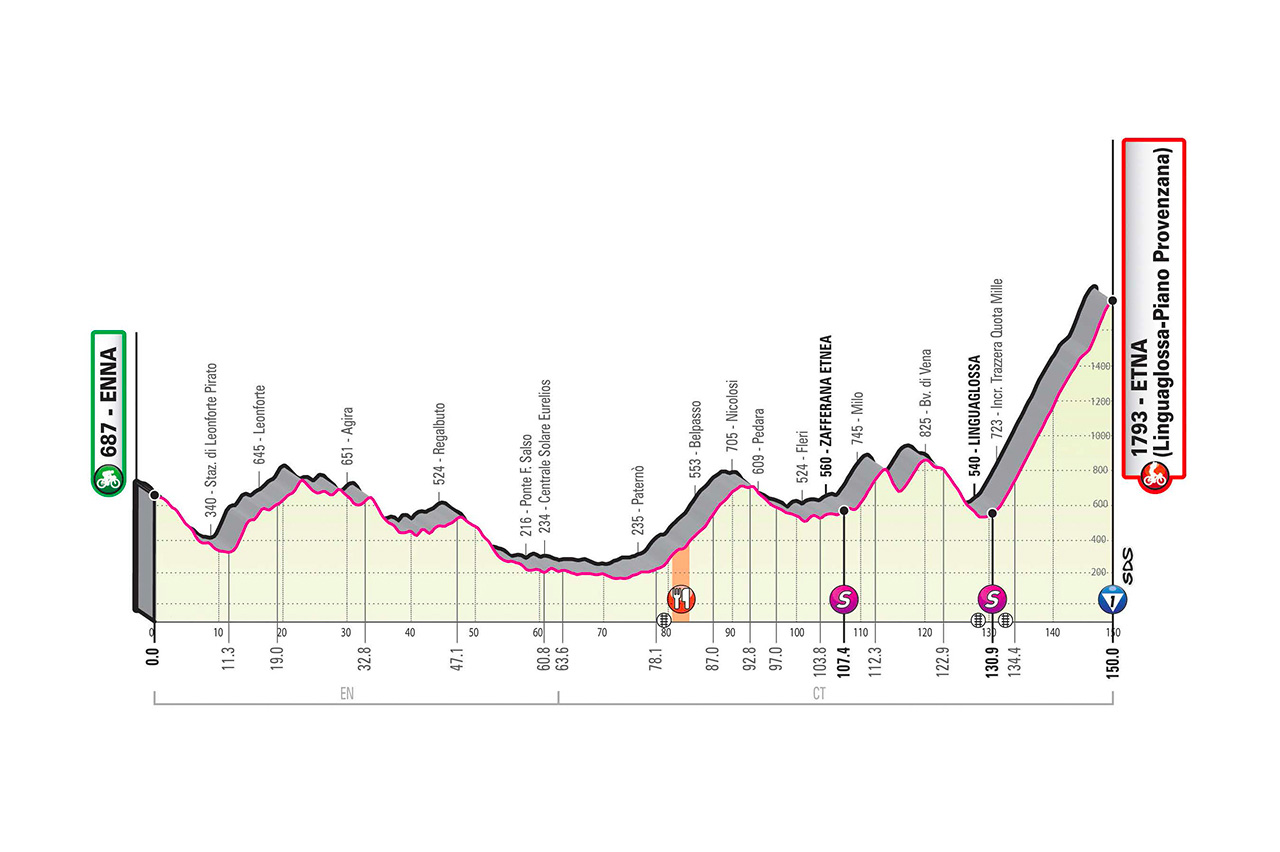
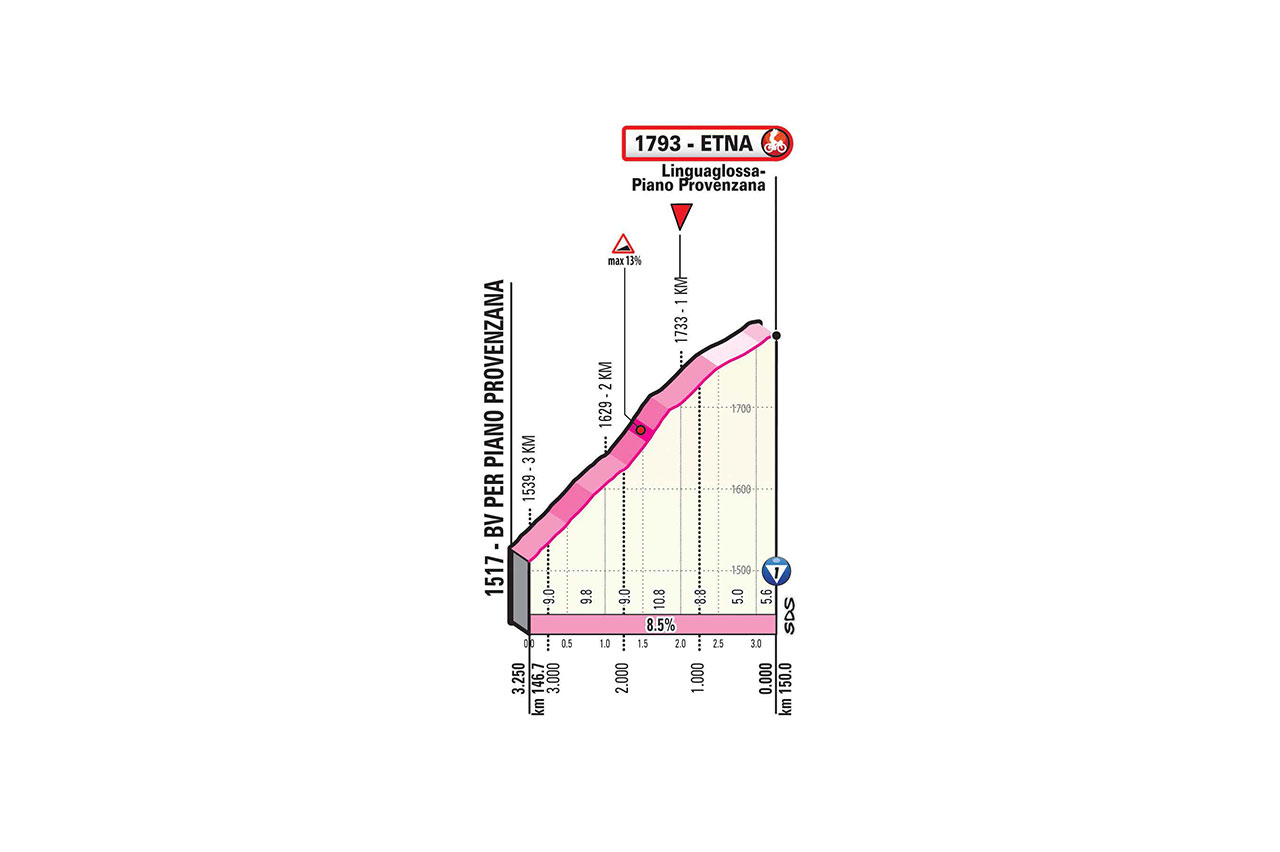
150.0
3325
2190
22.2
14.6
1!
gpx
04:02:33
+32:17
37.1 32.7
1:37 1:50
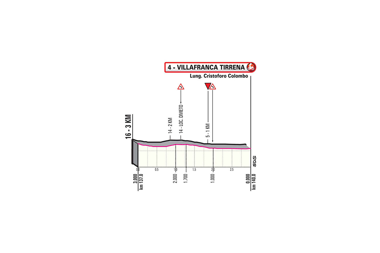
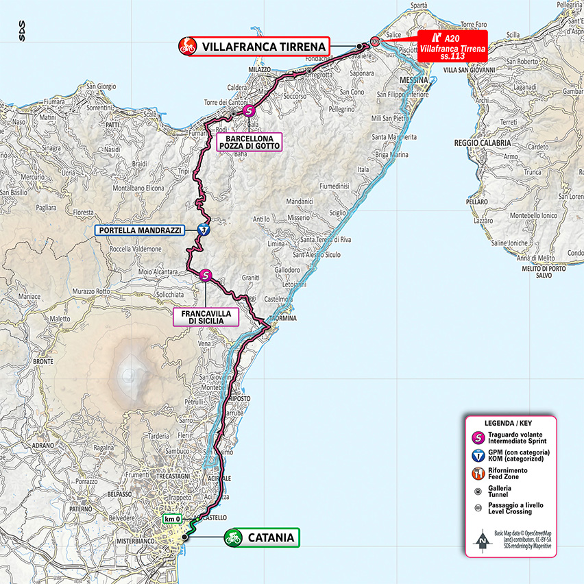
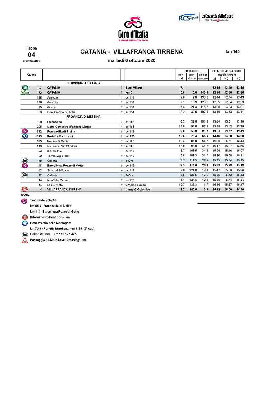
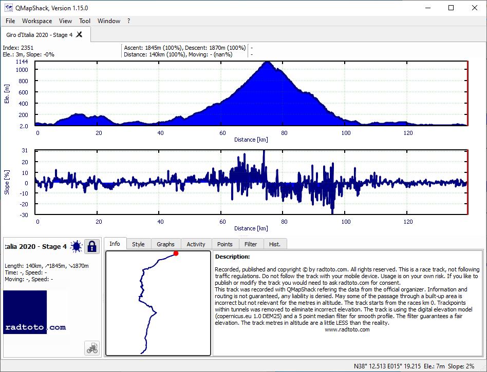
4
Tu.
6.
Oct
140.0
1845
1870
13.2
13.4
3
gpx
03:22:13
+13:33
41.5 38.9
1:27 1:32
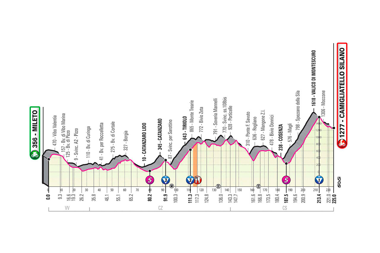
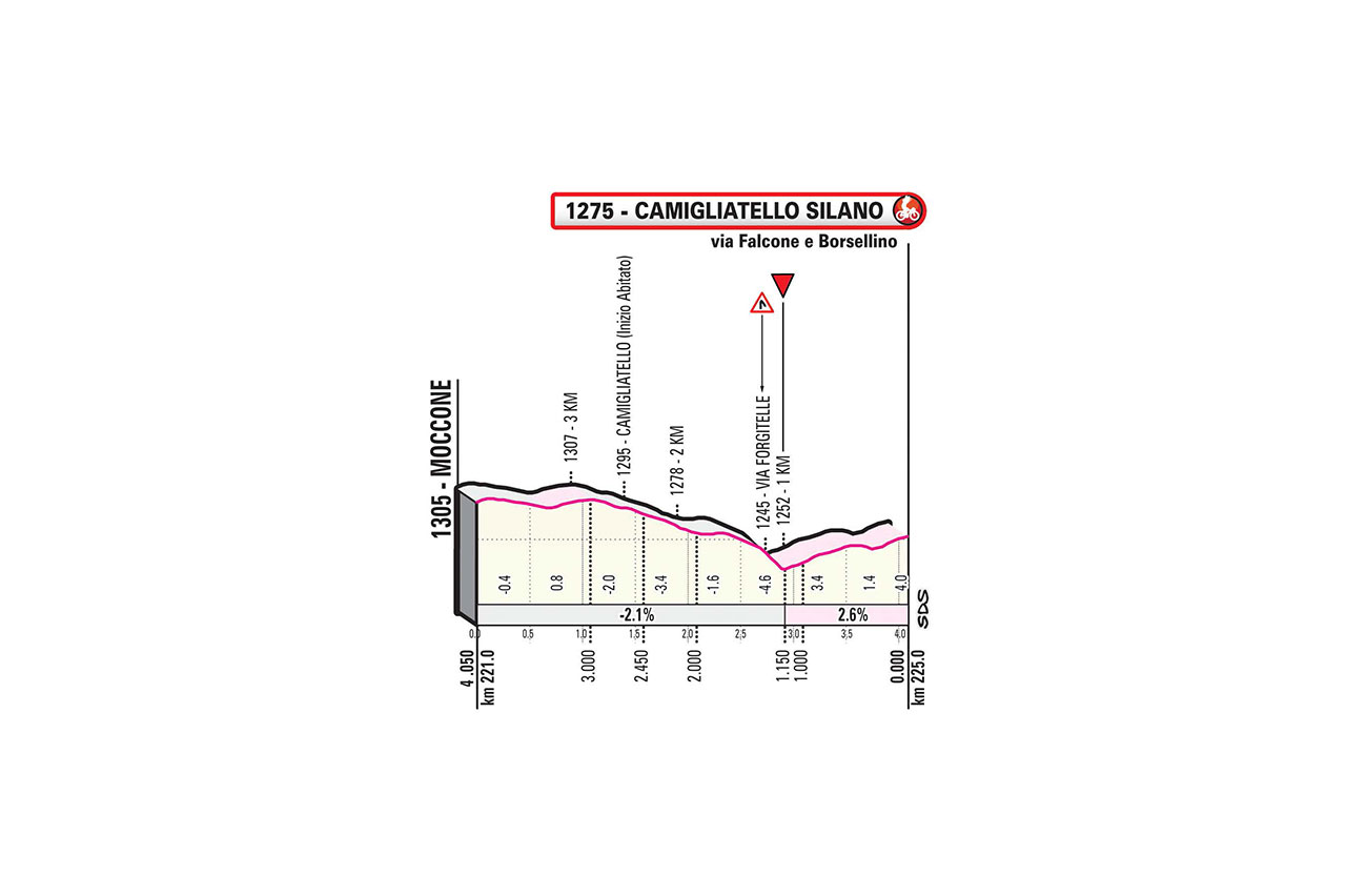
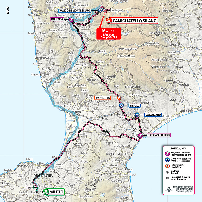
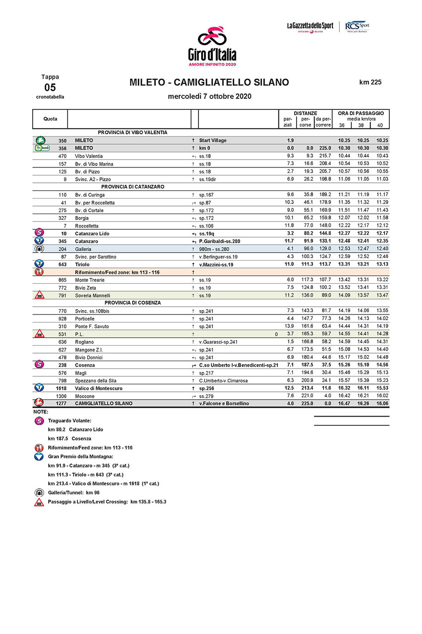
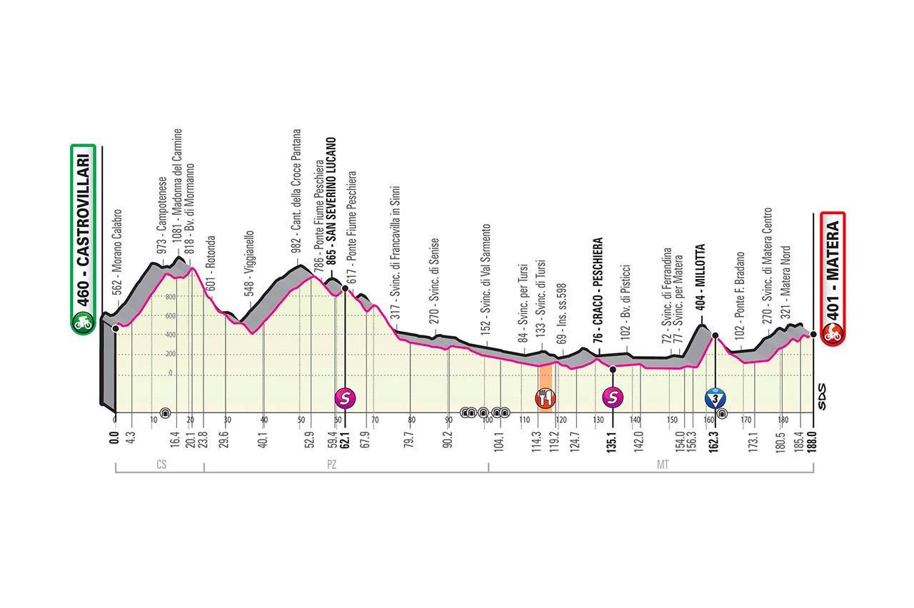
5
We.
7.
Oct
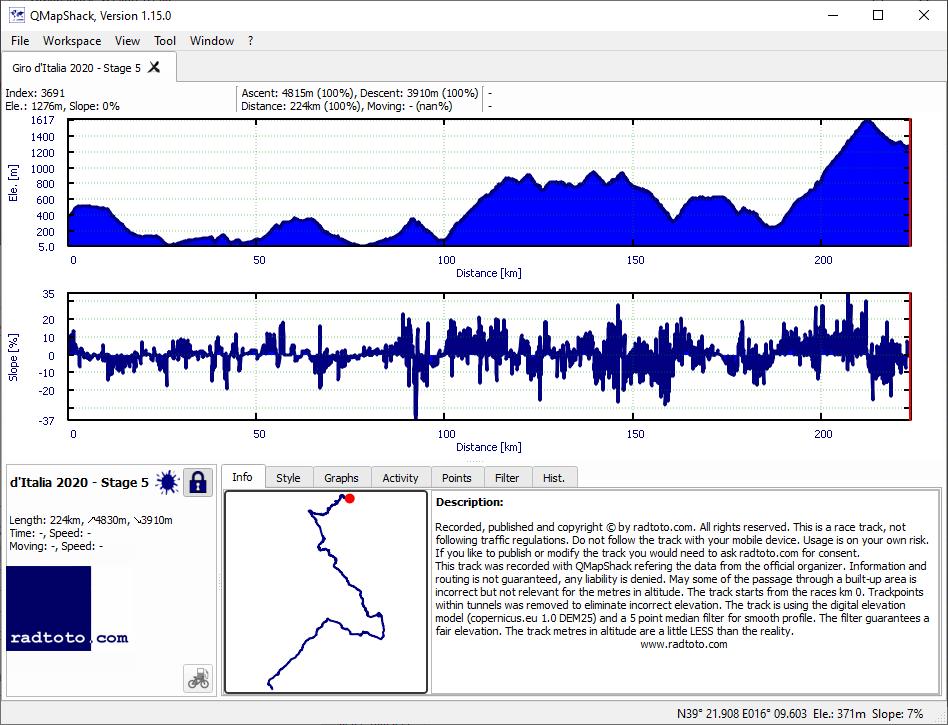
225.0
4830
3910
21.5
17.4
3-3-1
gpx
05:59:17
+28:56
37.6 34.8
1:36 1:44
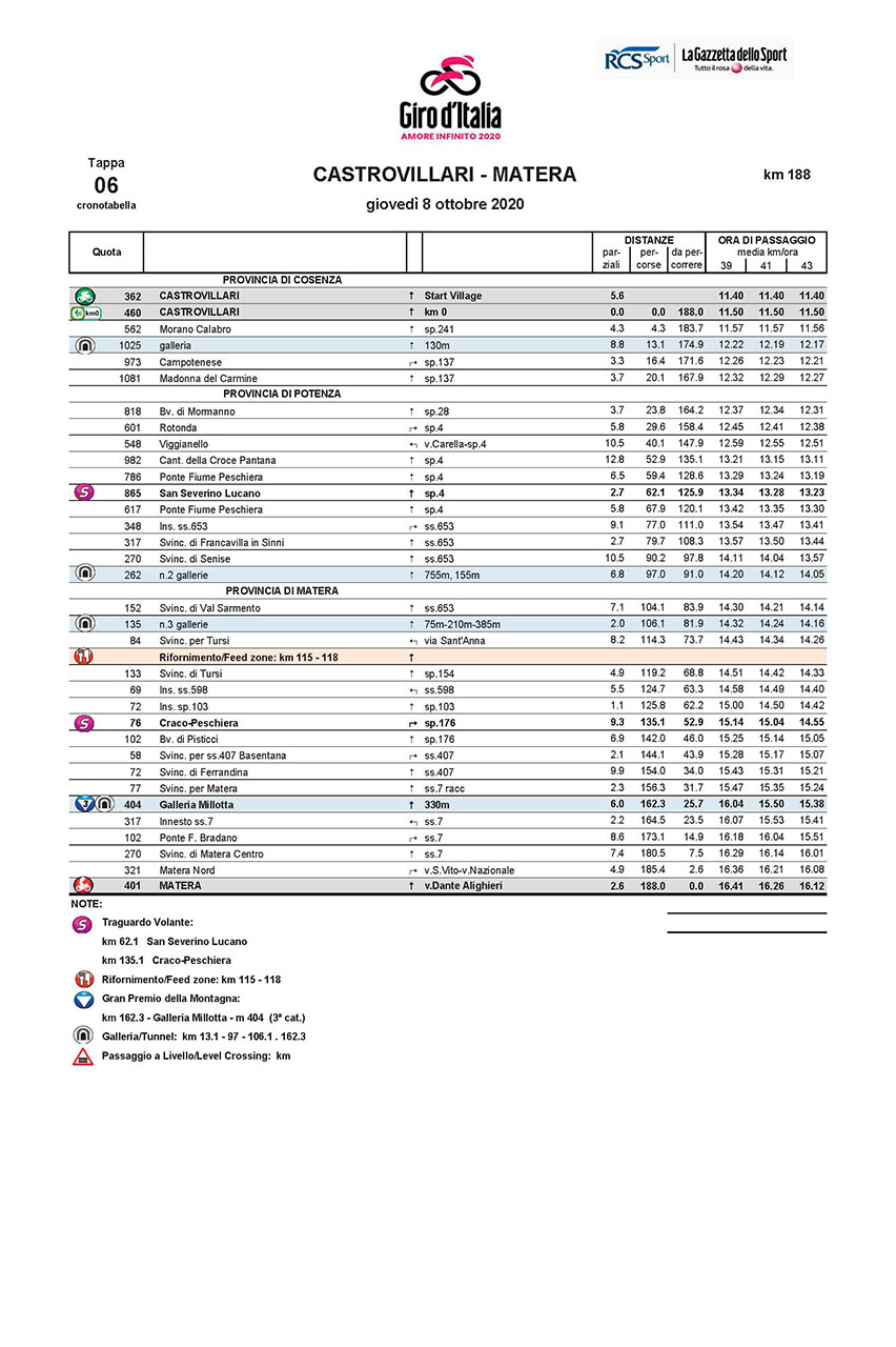
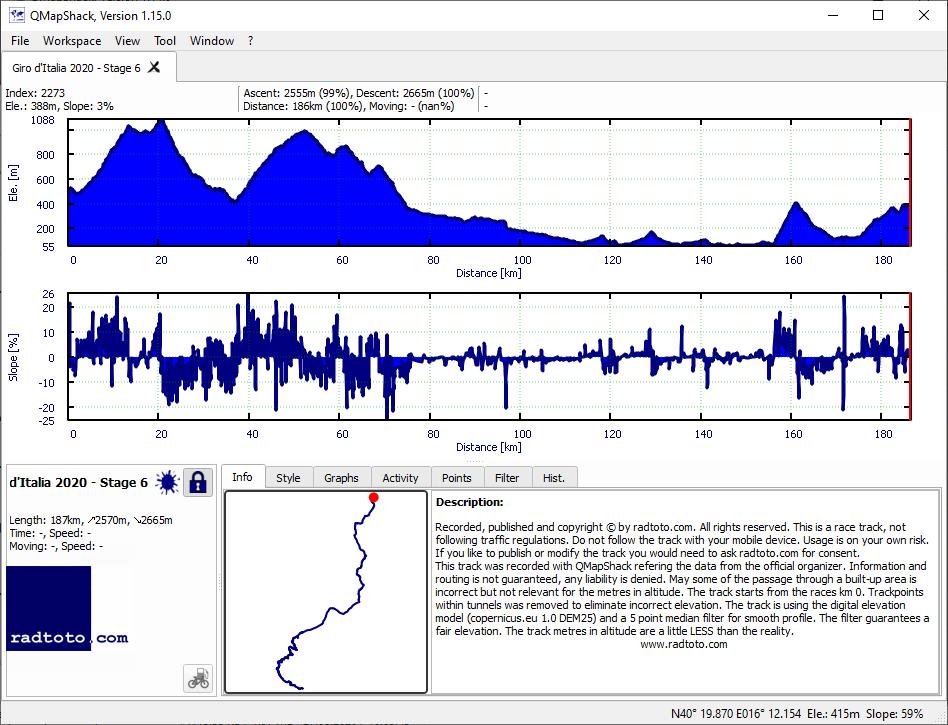
6
Th.
8.
Oct
188.0
2570
2665
13.7
14.2
3
gpx
04:54:38
+11:37
38.3 36.8
1:34 1:38
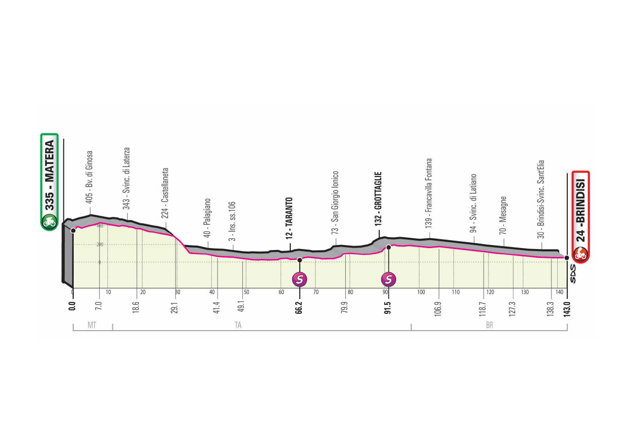
7
Fr.
9.
Oct
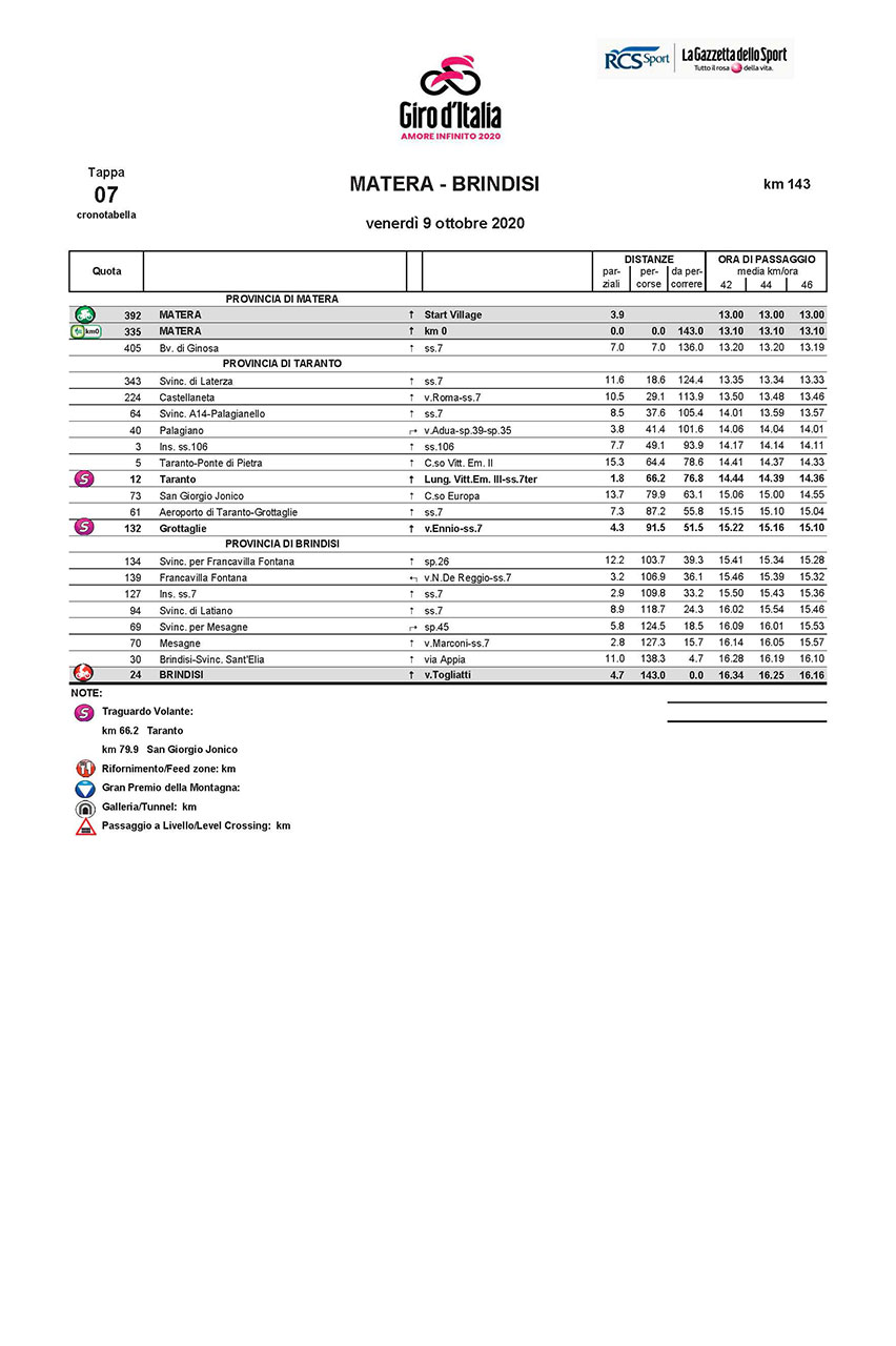
143.0
310
620
2.2
4.3
gpx
02:47:28
+21:27
51.2 45.4
1:10 1:19
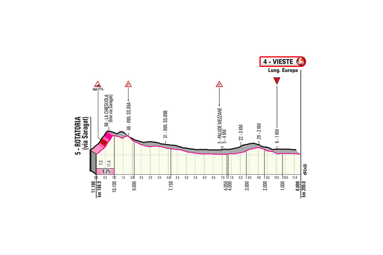
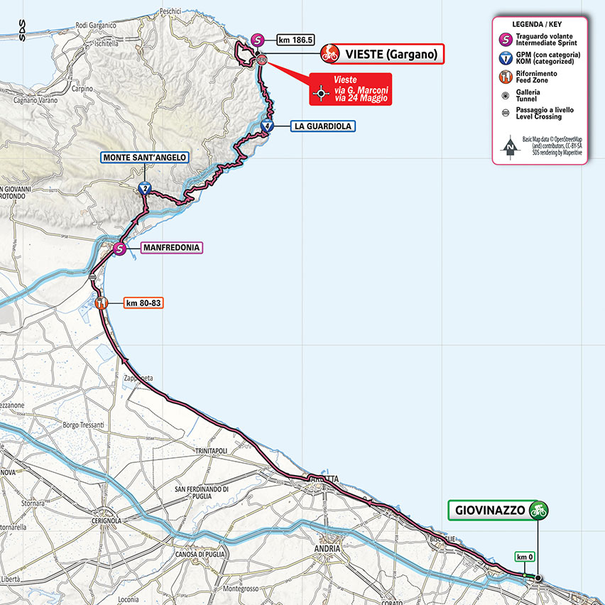
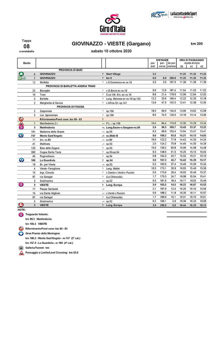
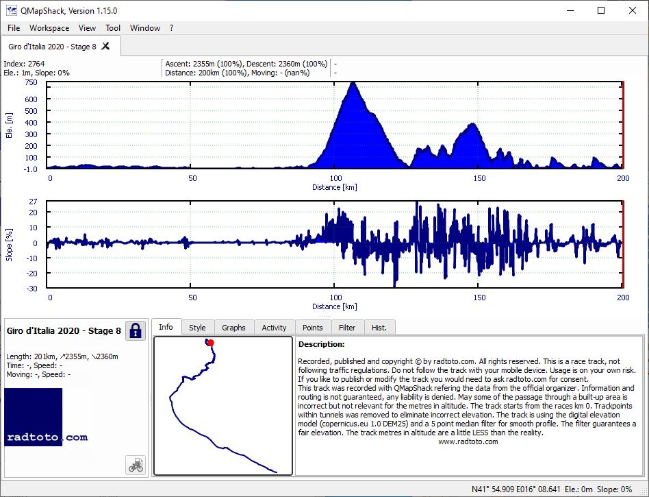
8
Sa.
10.
Oct
200.0
2355
2360
11.8
11.8
2-4
gpx
04:50:09
+17:16
41.4 39.0
1:27 1:32
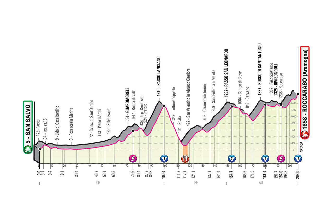
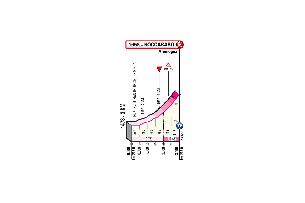
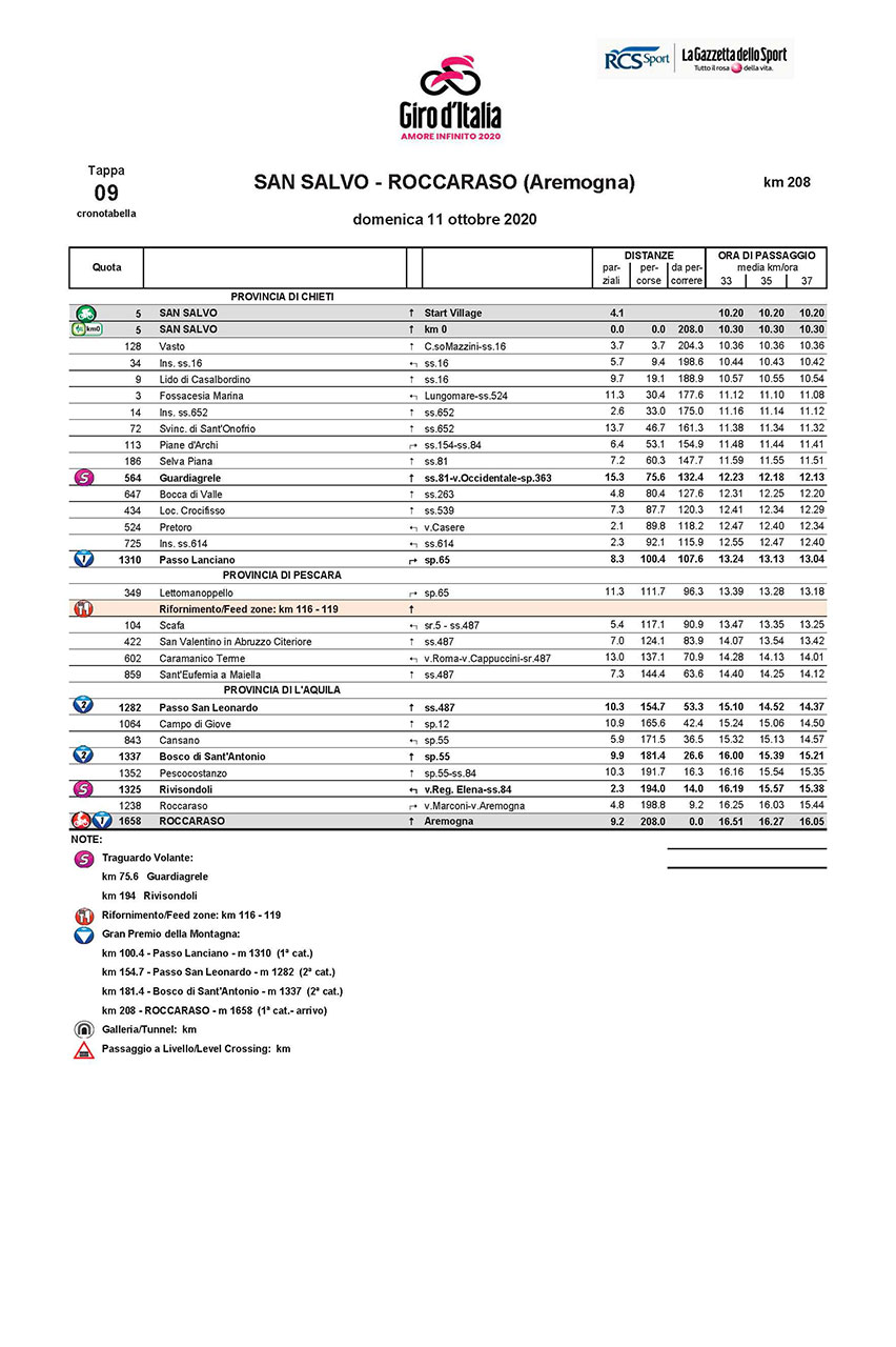
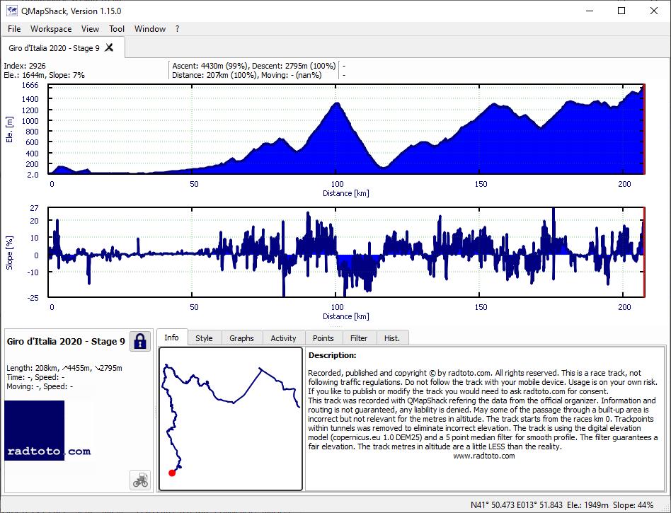
9
Su.
11.
Oct
208.0
4455
2795
21.4
13.4
1-2-2-1!
gpx
05:41:20
+40:23
36.6 32.7
1:38 1:50
R
Mo.
12.
Oct
Rest day
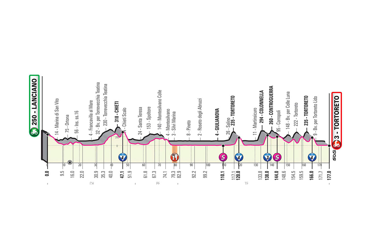
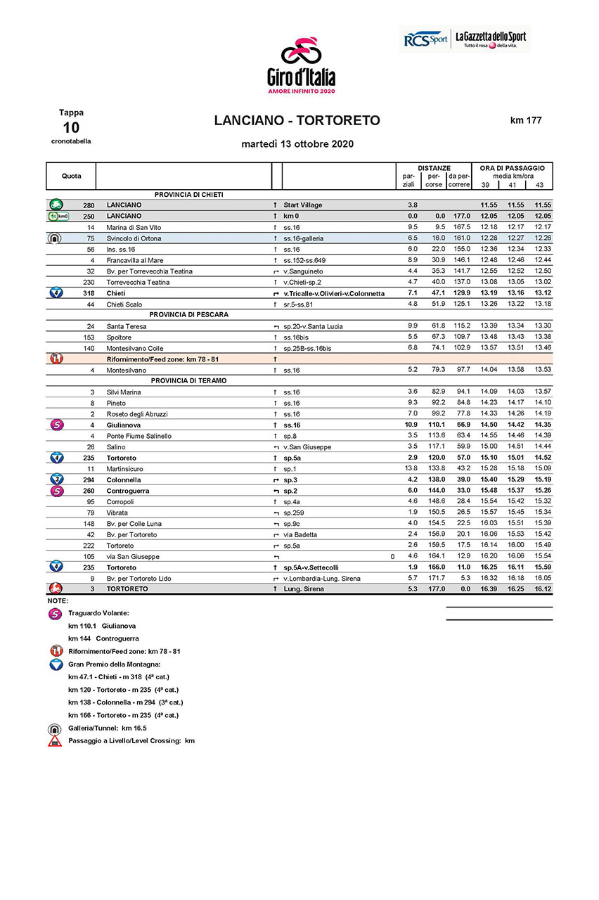
10
Tu.
13.
Oct
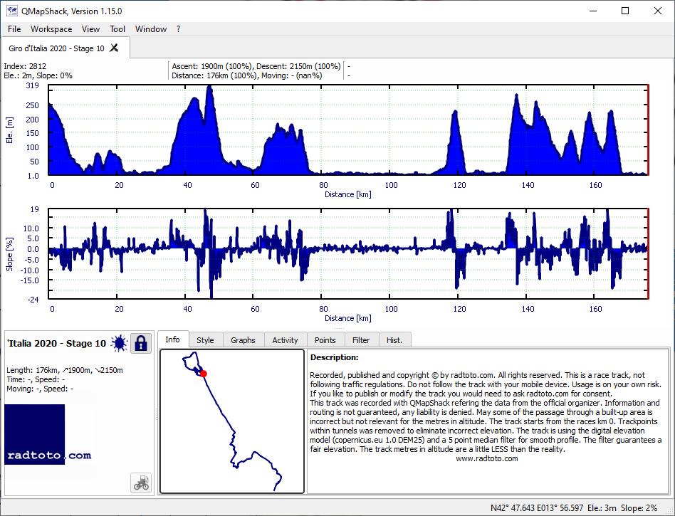
177.0
1900
2150
10.7
12.1
4-4-3-4
gpx
04:01:56
+22:09
43.9 40.2
1:22 1:30
11
We.
14.
Oct
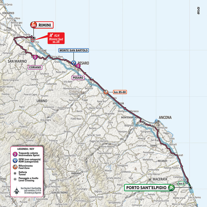
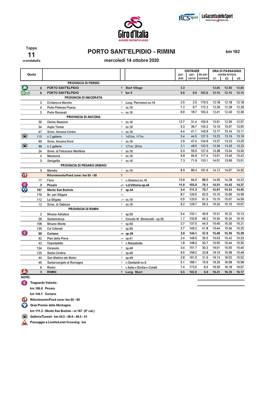
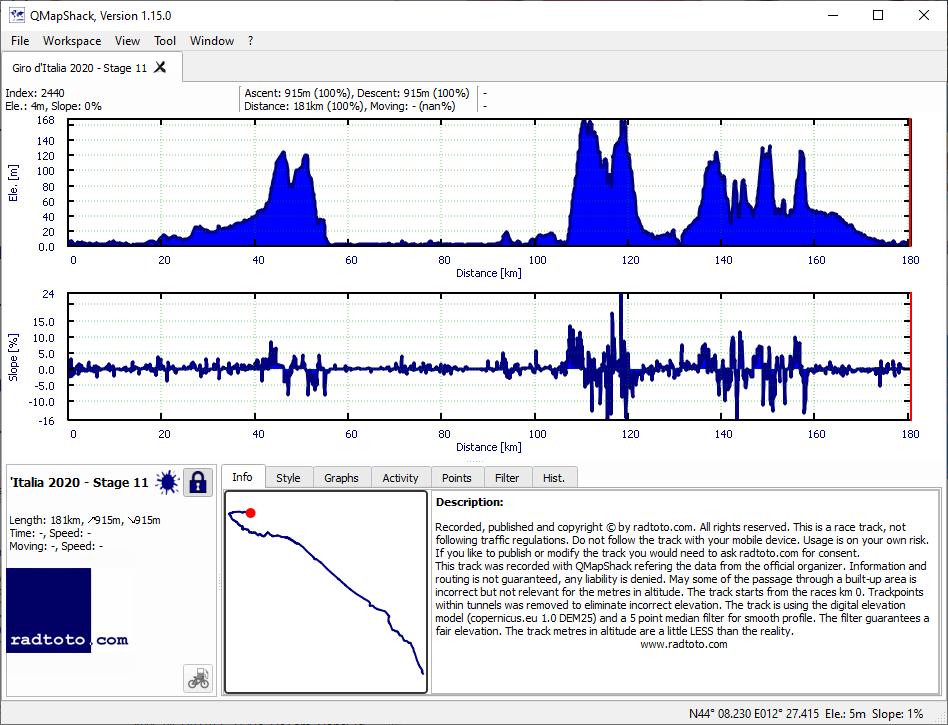
182.0
915
915
5.0
5.0
4
gpx
04:03:52
+8:57
44.8 43.2
1:20 1:23
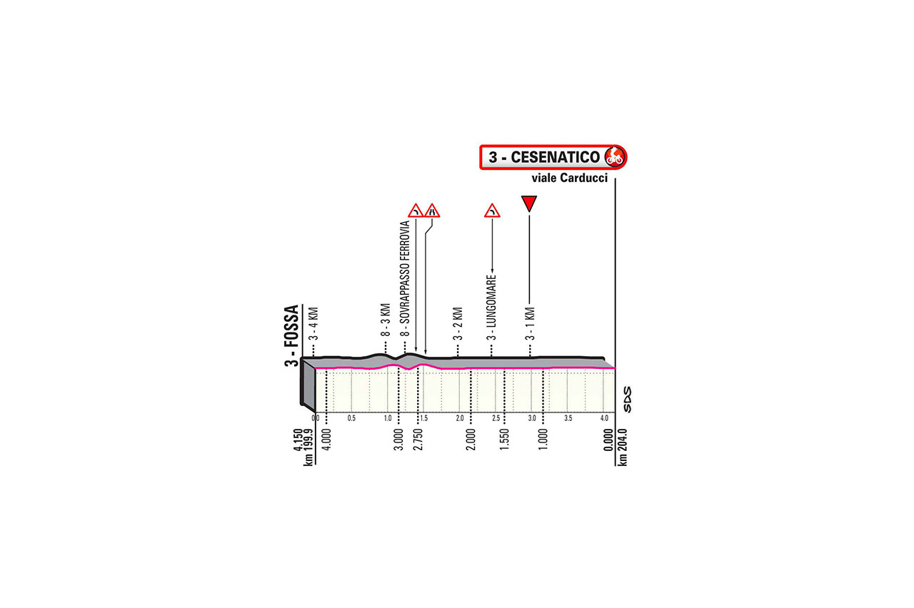
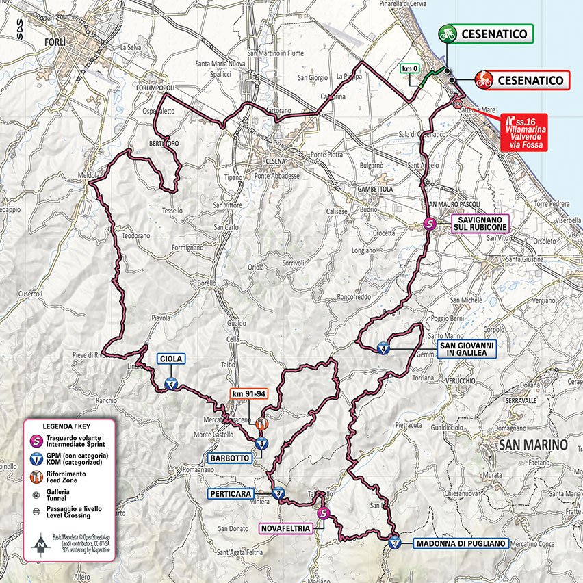
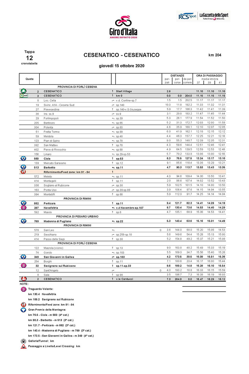
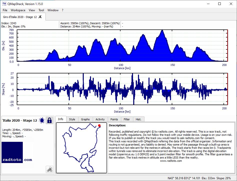
12
Th.
15.
Oct
204.0
3585
3585
17.6
17.6
4-3-3-3-4
gpx
05:31:24
+34:28
36.9 33.5
1:37 1:48
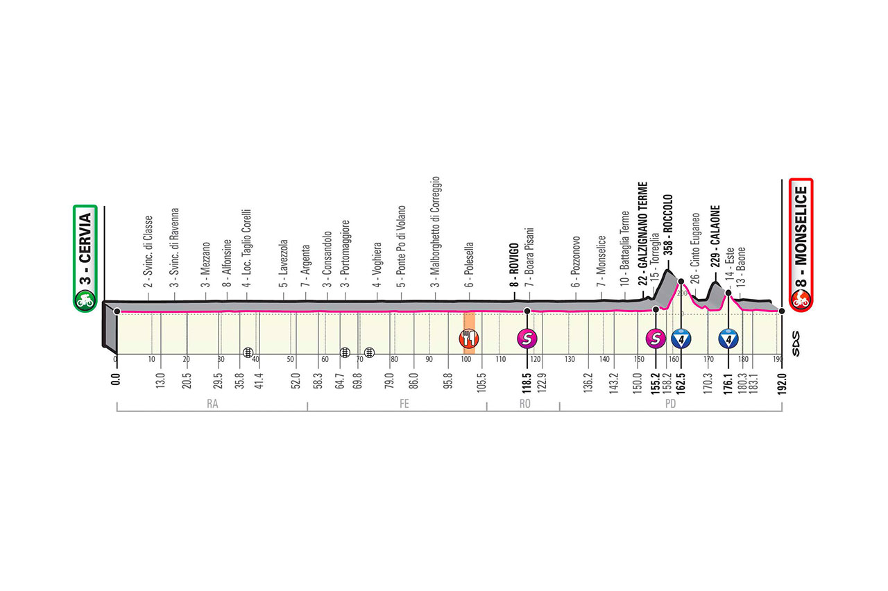
13
Fr.
16.
Oct
192.0
705
695
3.7
3.6
4-4
gpx
04:22:18
+14:11
43.9 41.7
1:22 1:26
14
Sa.
17.
Oct
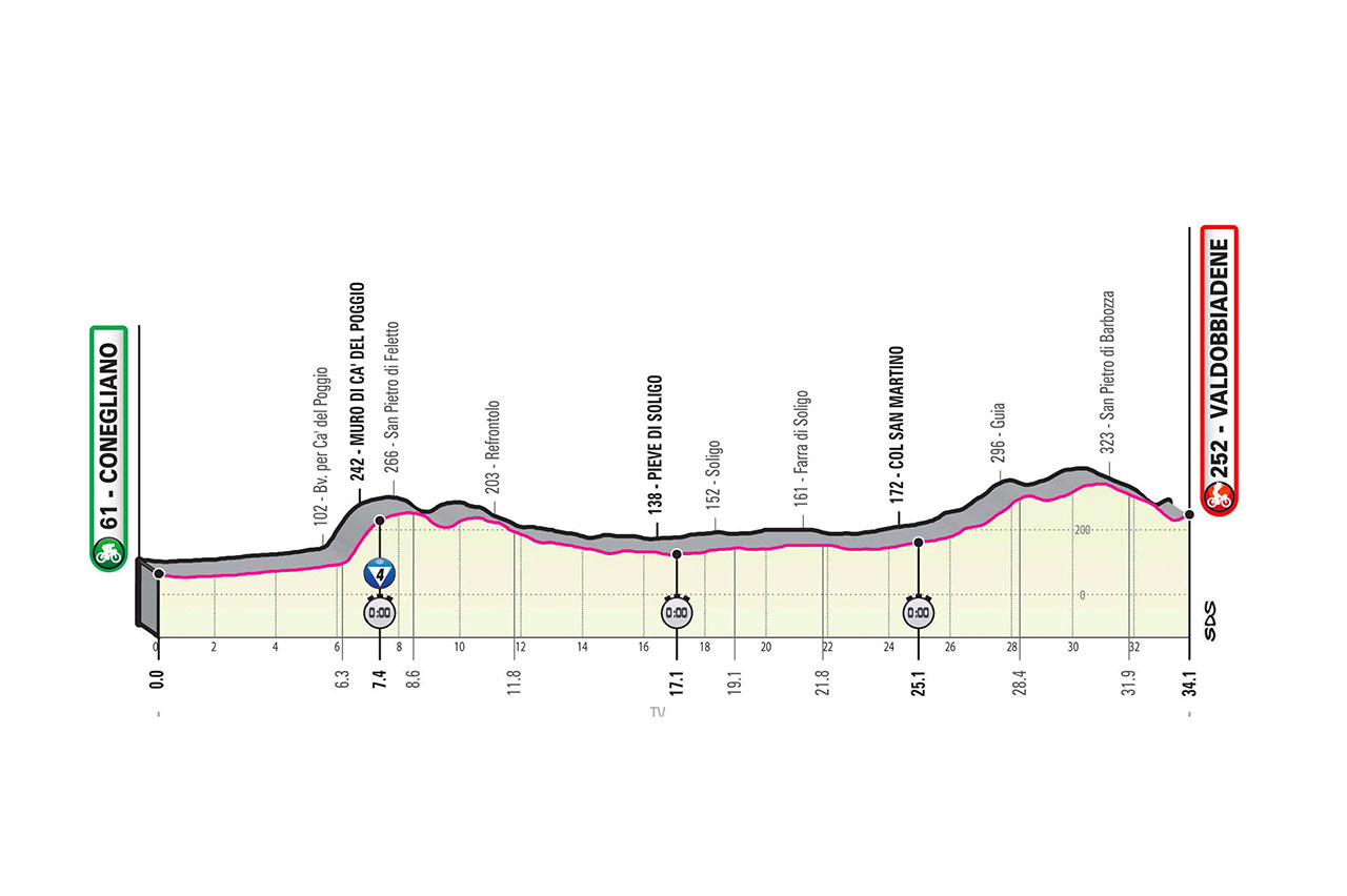
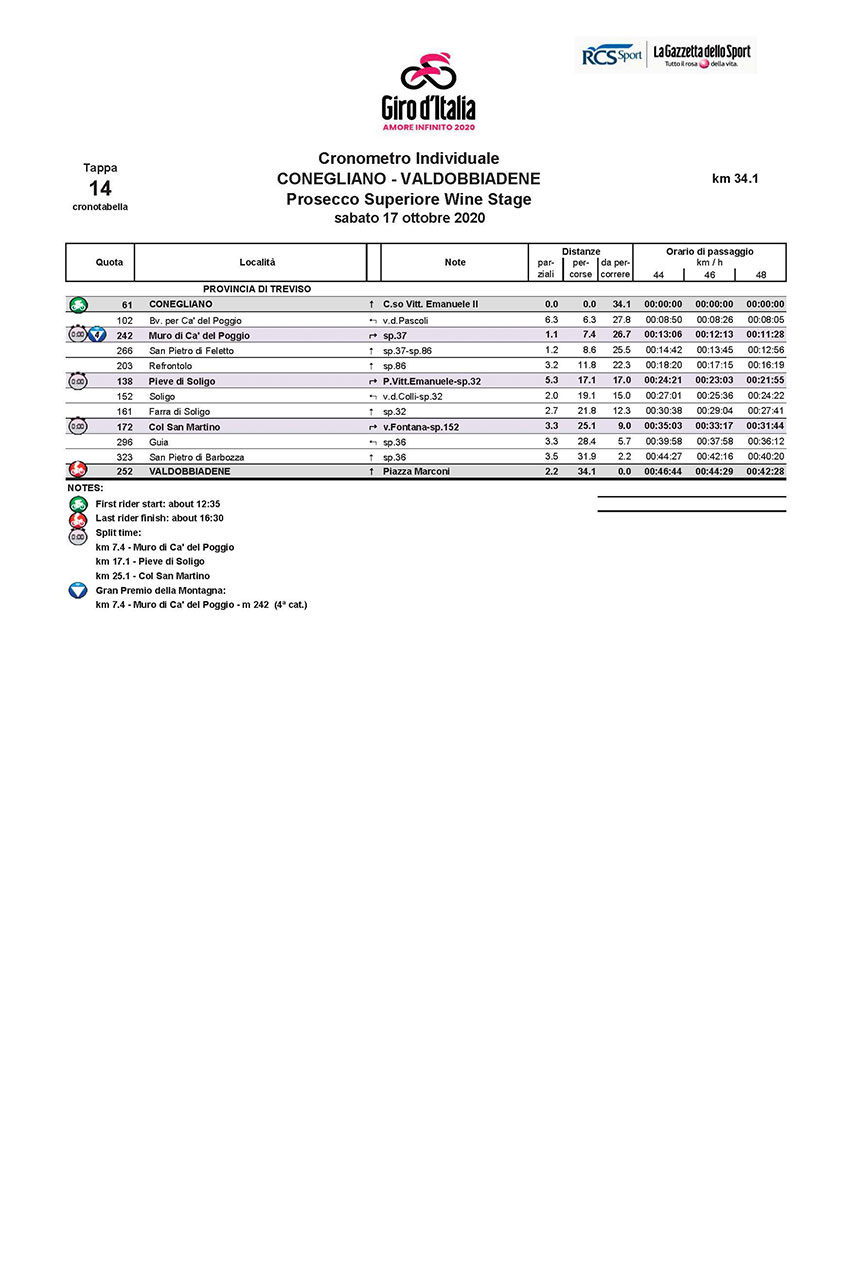
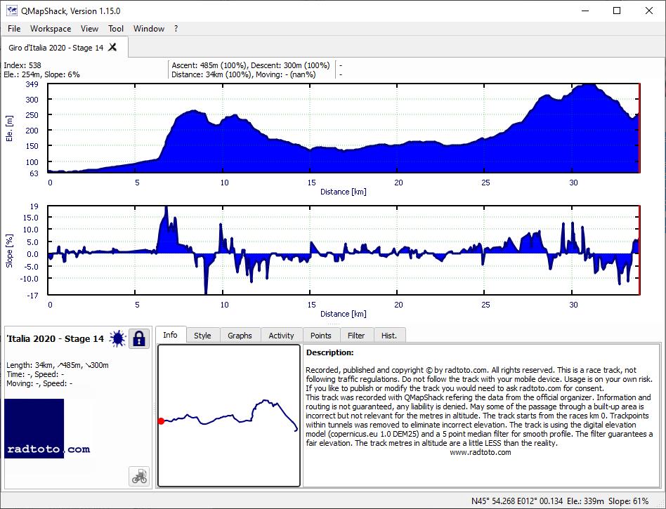
34.1
485
300
14.2
8.8
ITT-4
gpx
00:42:40
+15:51
48.0 35.0
1:15 1:43
15
Su.
18.
Oct
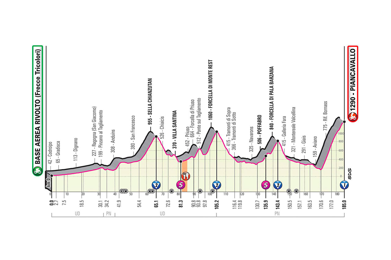
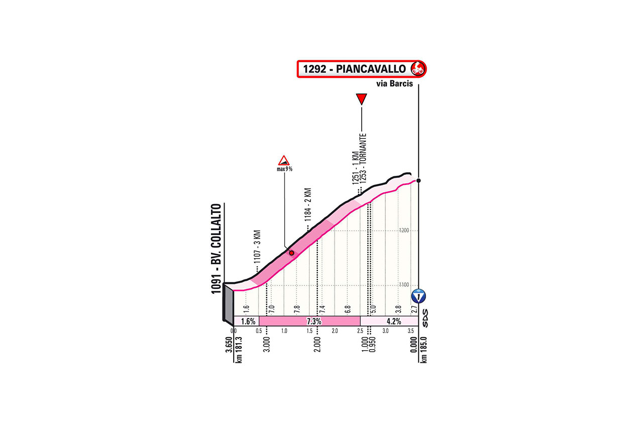
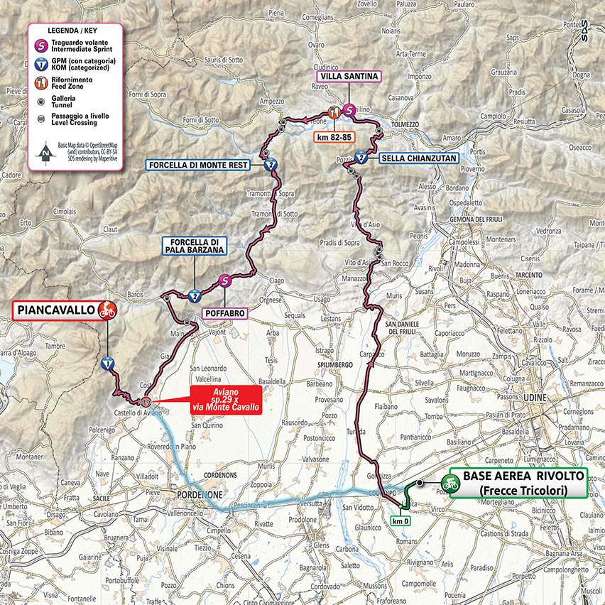
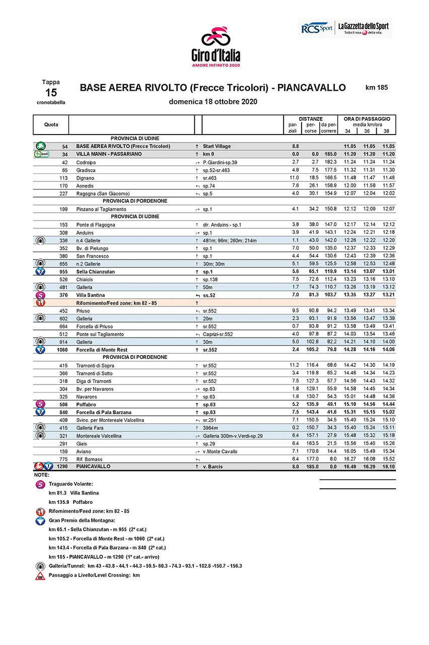
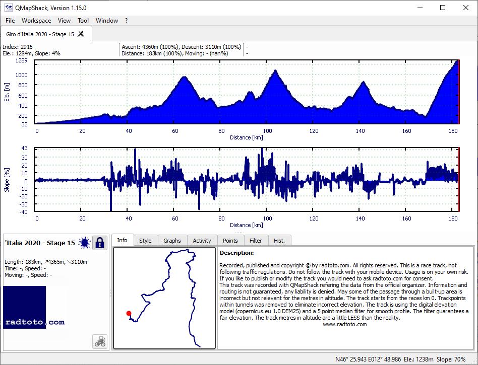
185.0
4365
3110
23.6
16.8
2-2-2-1!
gpx
04:58:52
+40:55
37.1 32.7
1:37 1:50
R
Mo.
19.
Oct
Rest day
16
Tu.
20.
Oct
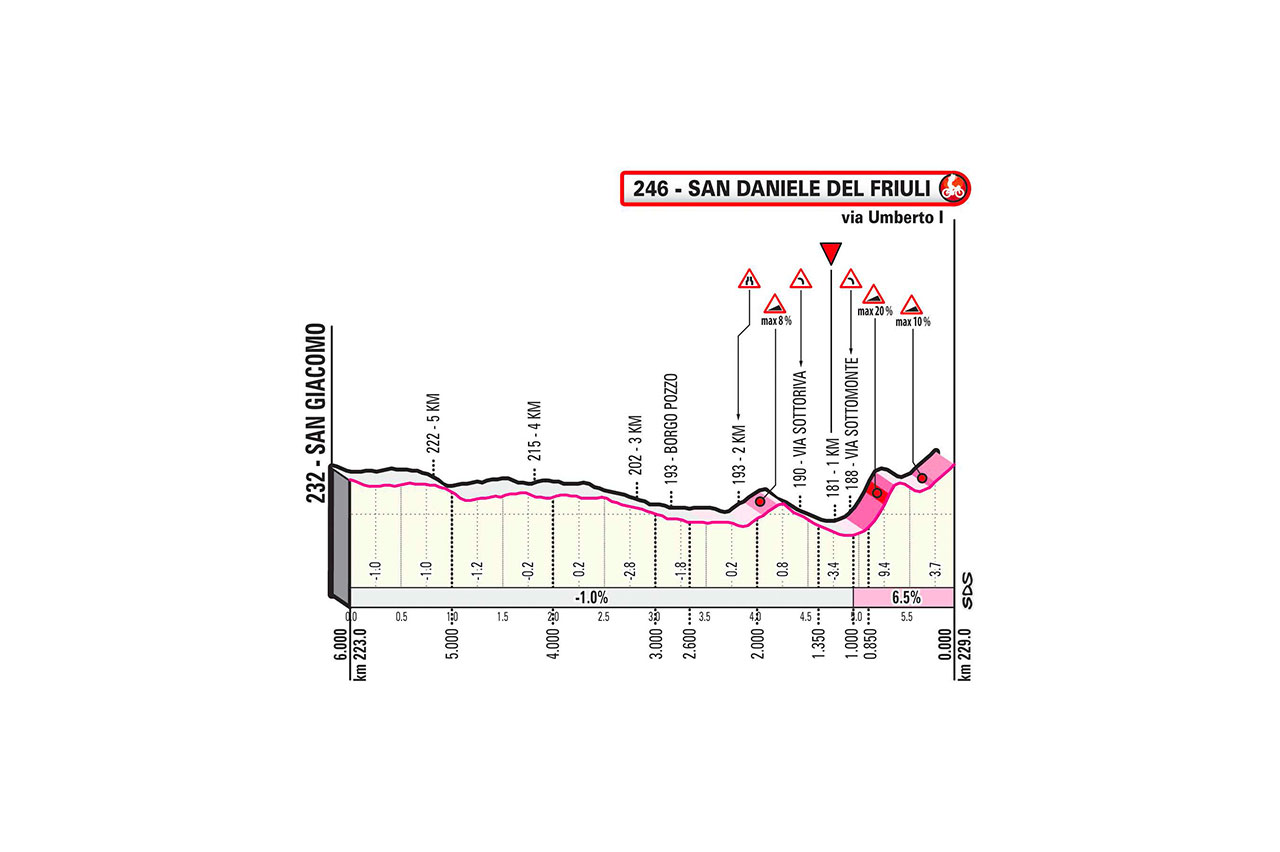
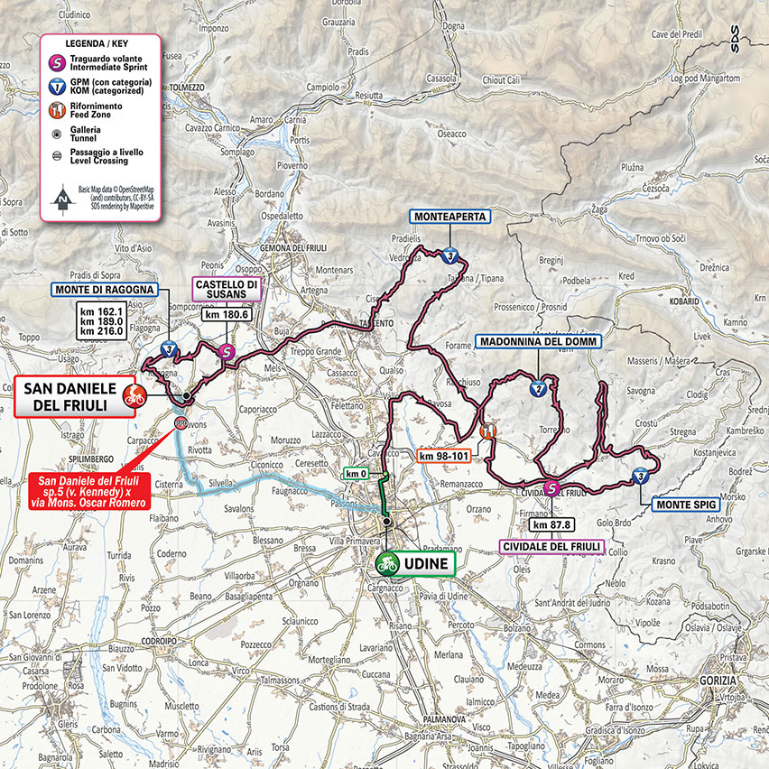
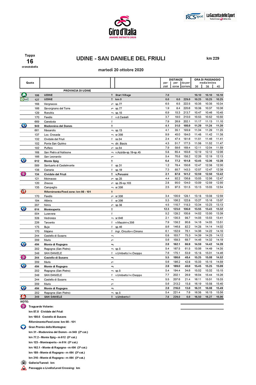
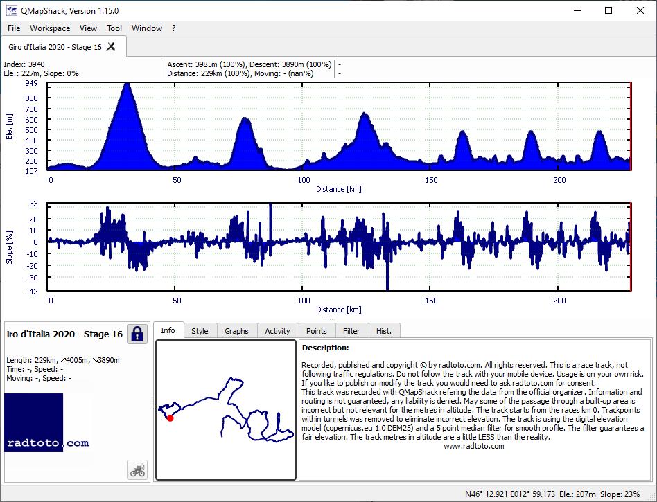
229.0
4005
3890
17.5
17.0
2-3-3-3-3-3
gpx
06:04:36
+27:52
37.7 35.0
1:36 1:43
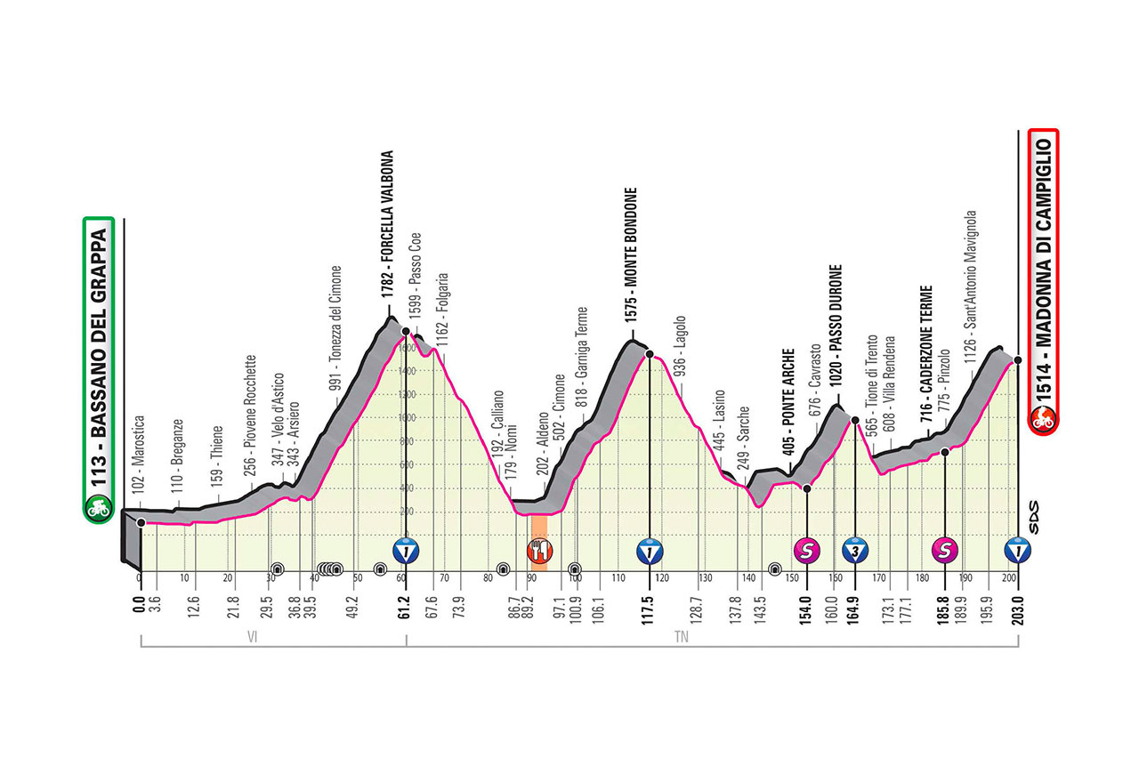
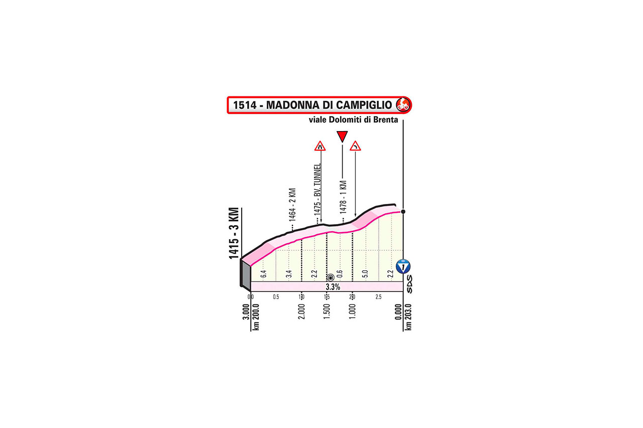
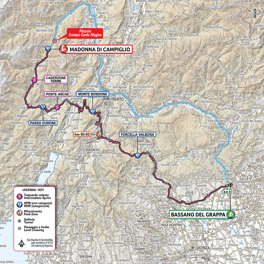
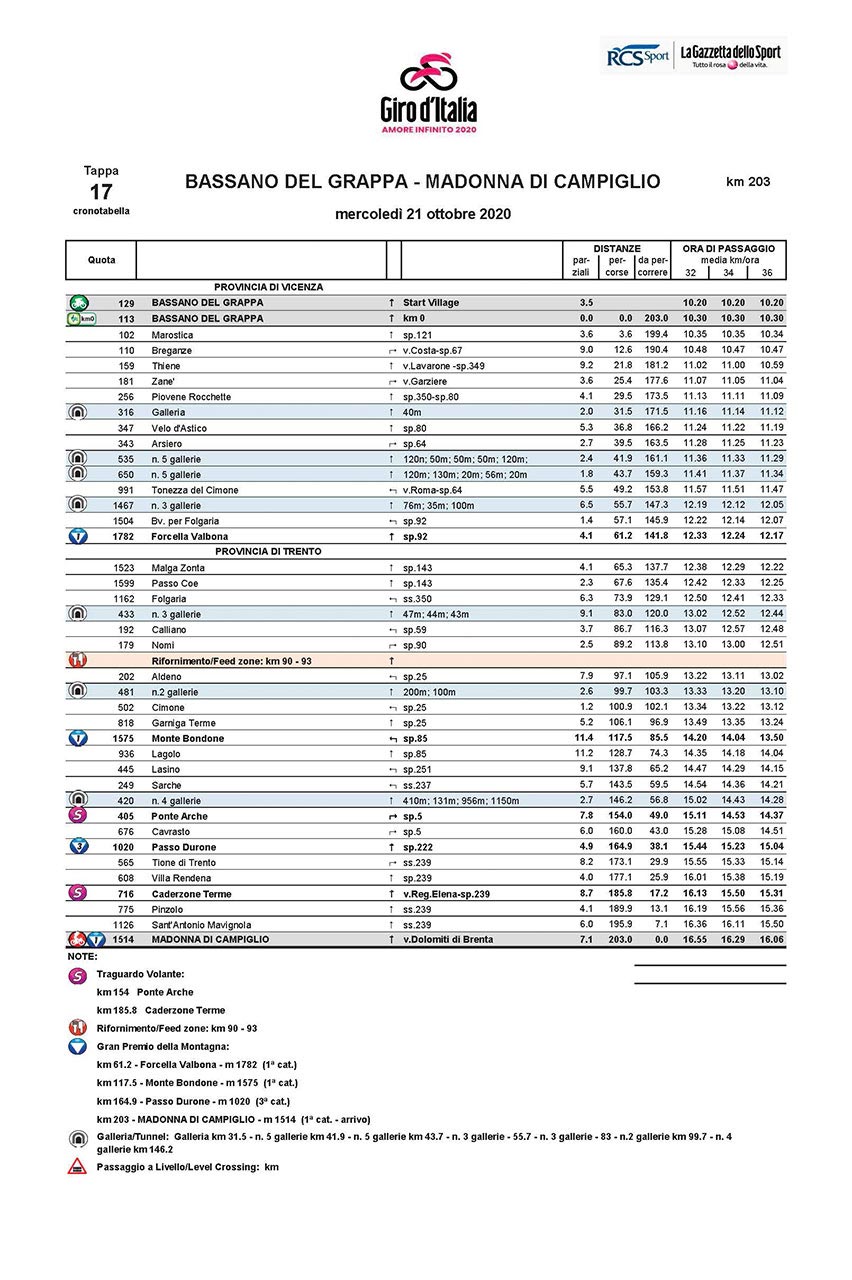
17
We.
21.
Oct
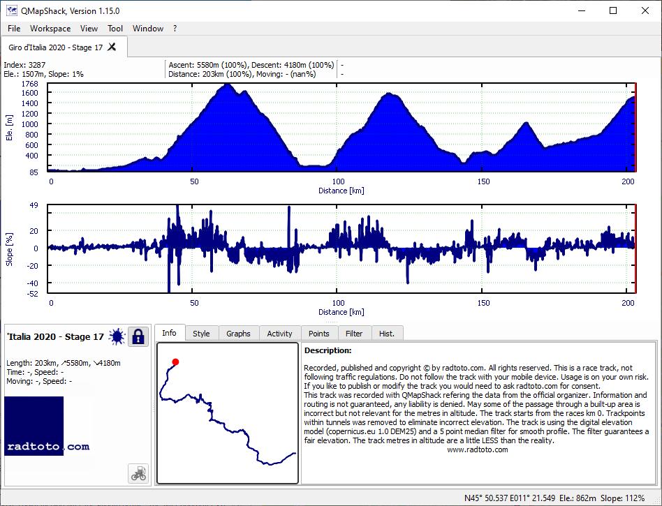
203.0
5580
4180
27.5
20.6
1-1-3-1!
gpx
05:50:59
+46:13
34.7 30.7
1:44 1:57
18
Th.
22.
Oct
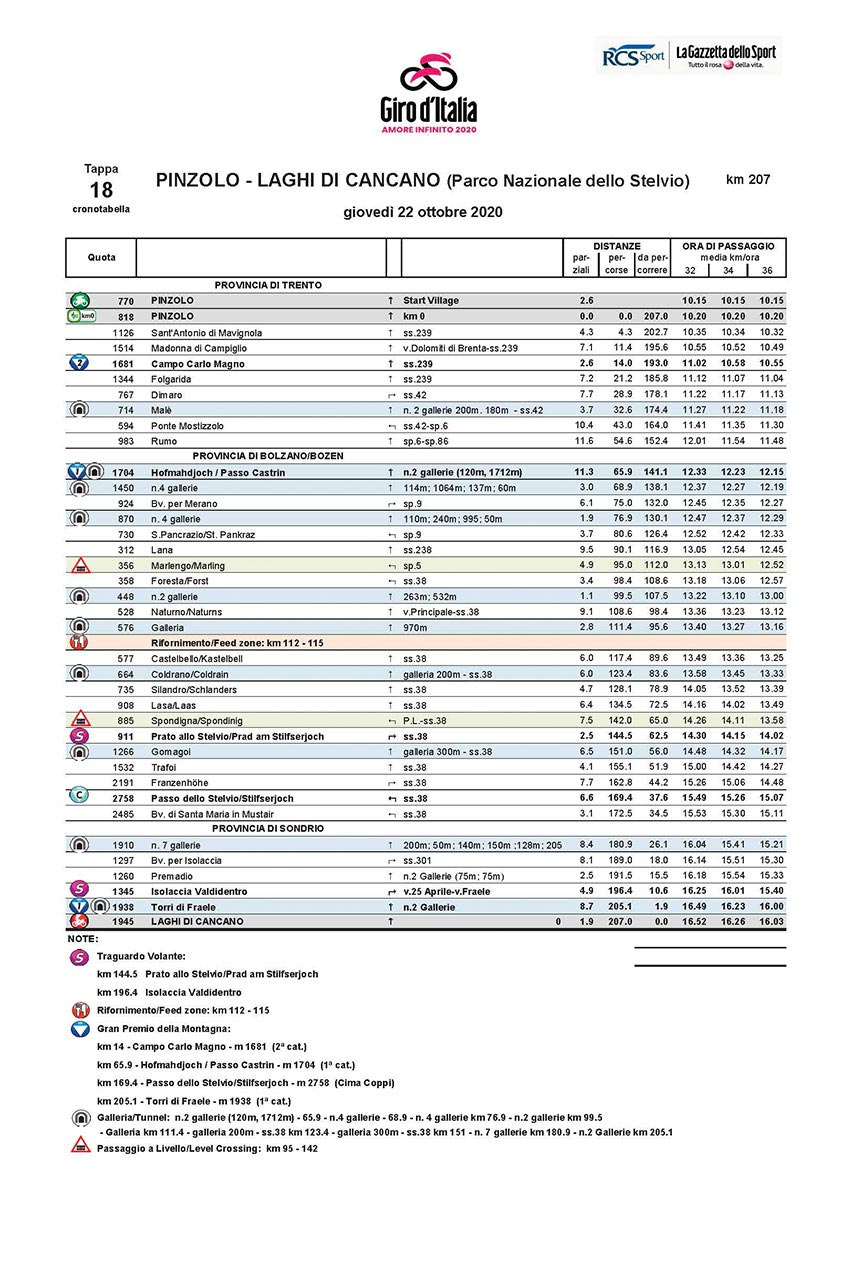
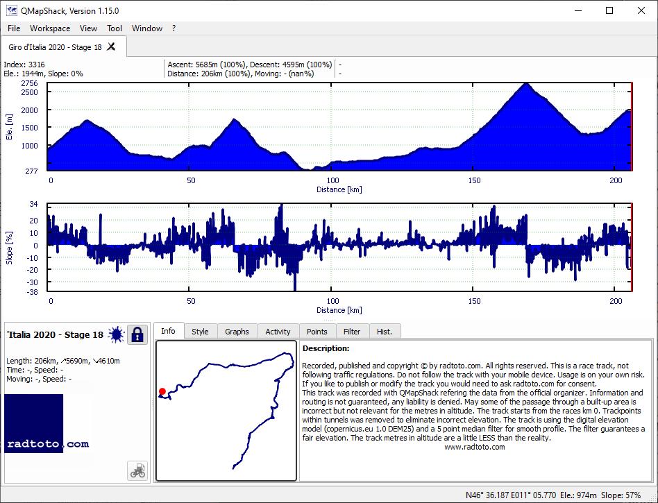
207.0
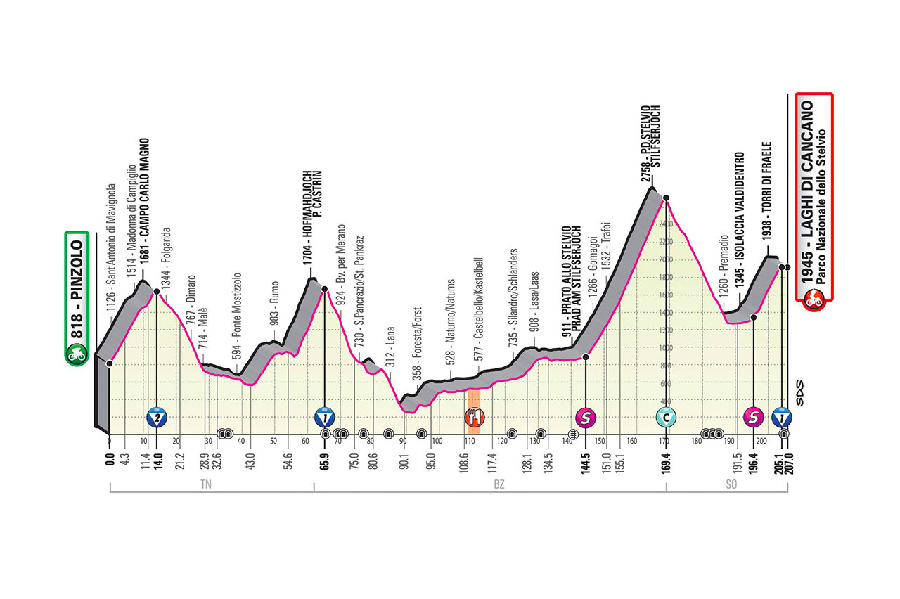
5690
4610
27.5
22.3
2-1-CC-1!
gpx
06:03:03
+50:58
34.2 30.0
1:45 2:00
19
Fr.
23.
Oct
124.0
350
345
2.8
2.8
gpx
02:30:40
+12:15
49.4 45.7
1:13 1:19
20
Sa.
24.
Oct
188.0
3495
1620
18.6
8.6
2-1-1!
gpx
04:52:45
+36:33
38.5 34.3
1:33 1:45
21
Su.
25.
Oct
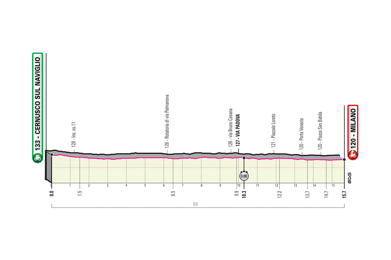
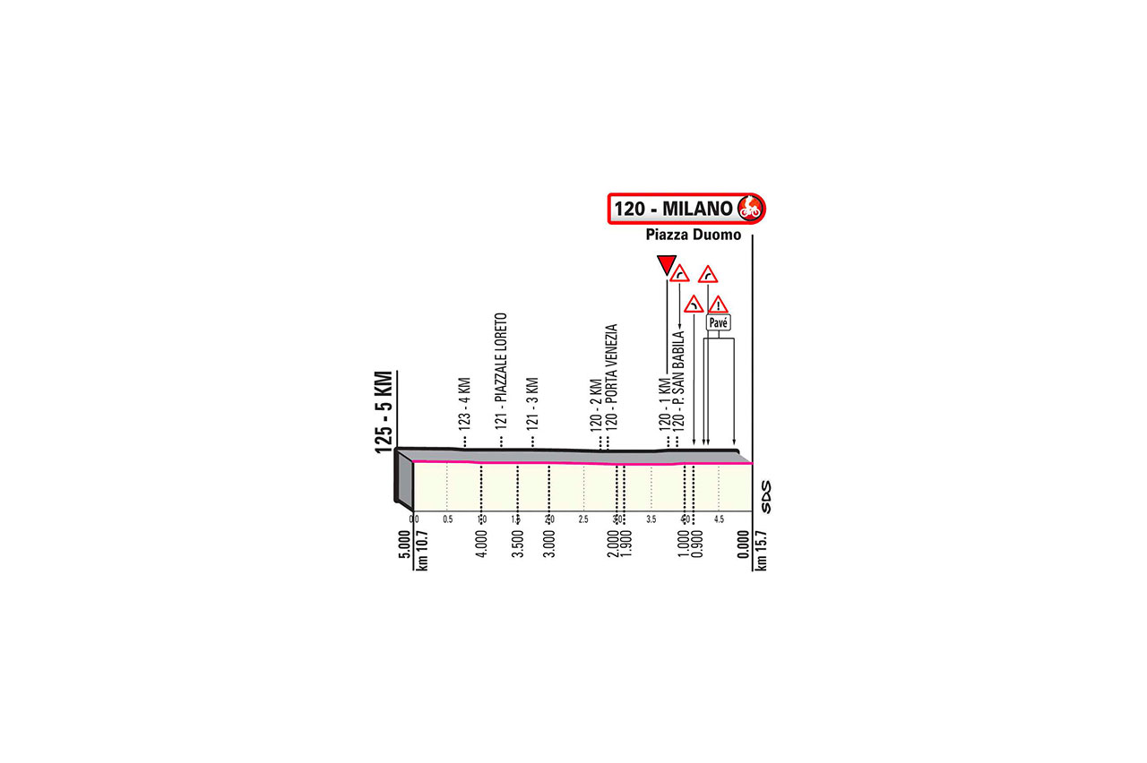
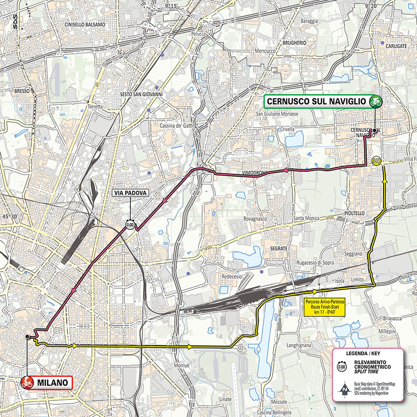
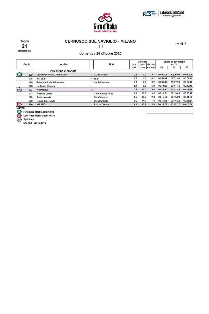
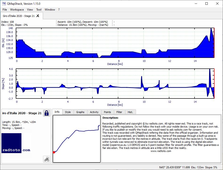
15.7
10
10
0.6
0.6
ITT
gpx
00:17:16
+4:12
54.6 43.9
1:06 1:22
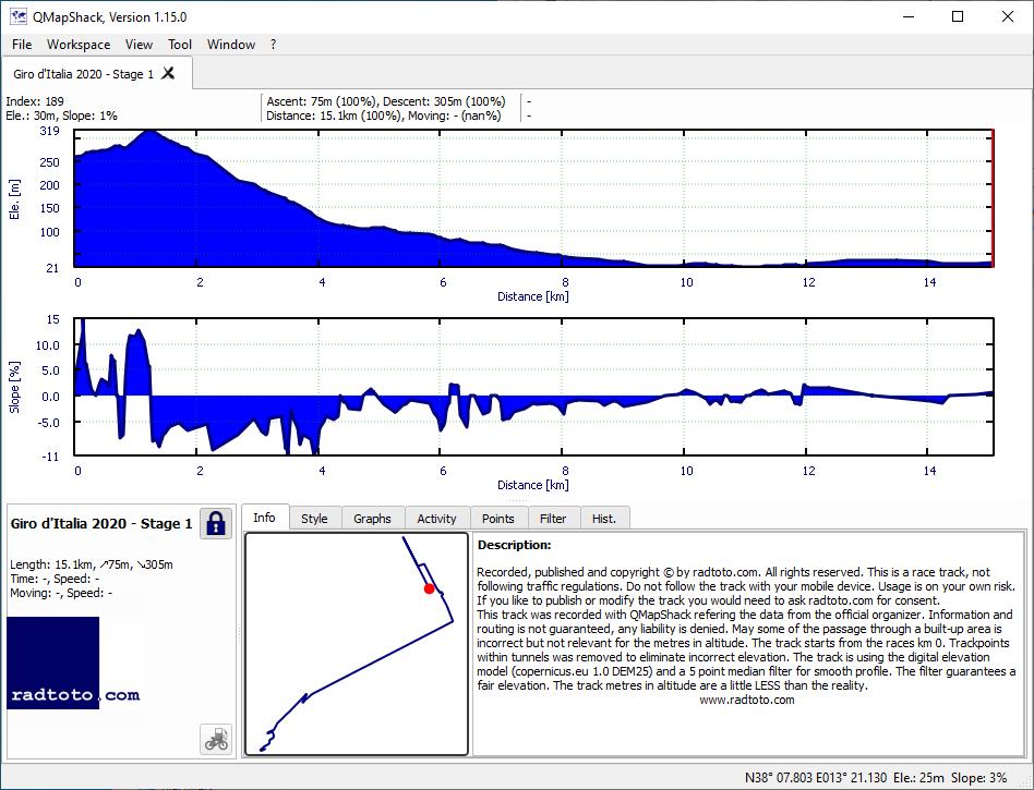
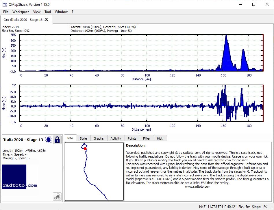
Attention the GPS-files (gpx) are race stages and do not follow the traffic rules. The usage of the GPS-files (gpx) is on your own risk, any liability is excluded. The stages, GPS-files (gpx) were recorded with QMapShack using the information from the official organizer. The stages have been drawn most accurate as possible. Each stage starts at race km 0 and does not include neutralized kilometers. Trackpoints within tunnels were removed to eliminate incorrect vertical meters. We use the digital elevation model (copernicus.eu 1.0 DEM25) and a 5 point median filter to smooth deviation of the track points.
The radtoto.com profiles, GPS-files (gpx) and all data on the page 'stages' were created and published by radtoto.com. Copyright © by radtoto.com, all rights reserved. If you like to modify or publish files or data, ask for our approval.
Copyright © 2004 - 2026 radtoto.com. All rights reserved.
🤡🤡
Aktuell: 2 Heute: 1023 Gestern: 2878 Gesamt: 21426 Seit: 19.07.2026





 52825
52825
 43935
Δ 8890
43935
Δ 8890