Home
|
Contact
Home
Competition
Grand Tours
Gallery
Contact
home
|
grand tours
|
stages
stages details
Vuelta a España 2026
Tour de France 2026
Giro d’Italia 2026
Vuelta a España 2025
Tour de France 2025
Giro d’Italia 2025
Vuelta a España 2024
Tour de France 2024
Giro d’Italia 2024
Vuelta a España 2023
Tour de France 2023
Giro d’Italia 2023
Vuelta a España 2022
Tour de France 2022
Giro d’Italia 2022
Vuelta a España 2021
Tour de France 2021
Giro d’Italia 2021
Vuelta a España 2020
Giro d’Italia 2020
Tour de France 2020
Vuelta a España 2019
Tour de France 2019
Giro d’Italia 2019
Vuelta a España 2018
Tour de France 2018
Giro d’Italia 2018
Vuelta a España 2017
Tour de France 2017
Giro d’Italia 2017
Vuelta a España 2016
Tour de France 2016
Giro d’Italia 2016
Vuelta a España 2015
Tour de France 2015
Giro d’Italia 2015
Tour de France 2025
112. Tour de France
July 5th to July 27th 2025
total kilometer
3302.0
total vertical meters
46575
35635 Δ 10940
Ø stage severity © STS
14.1
10.8
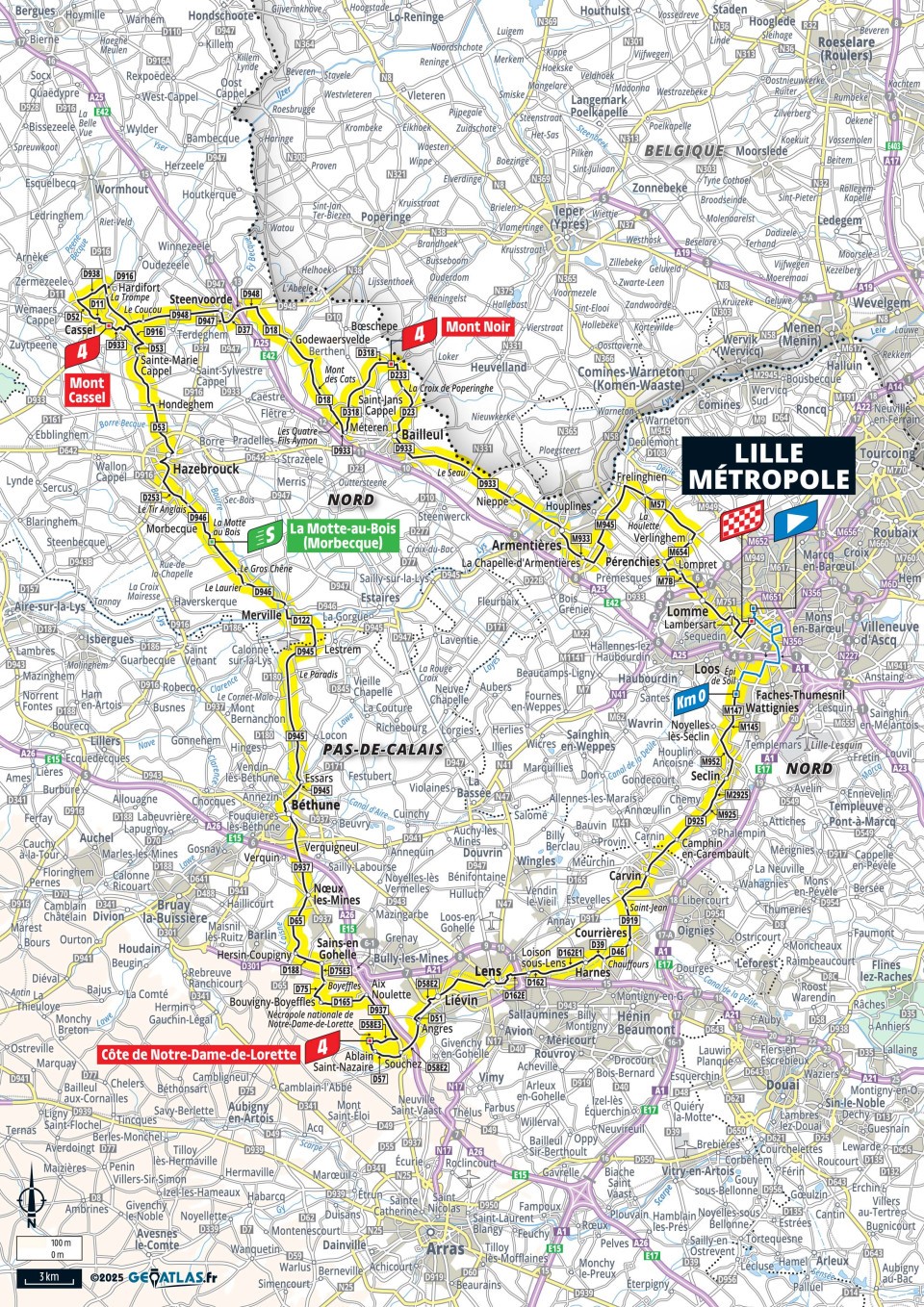
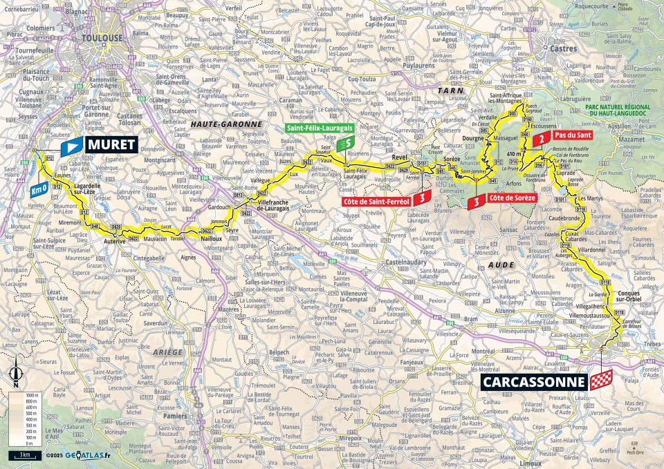
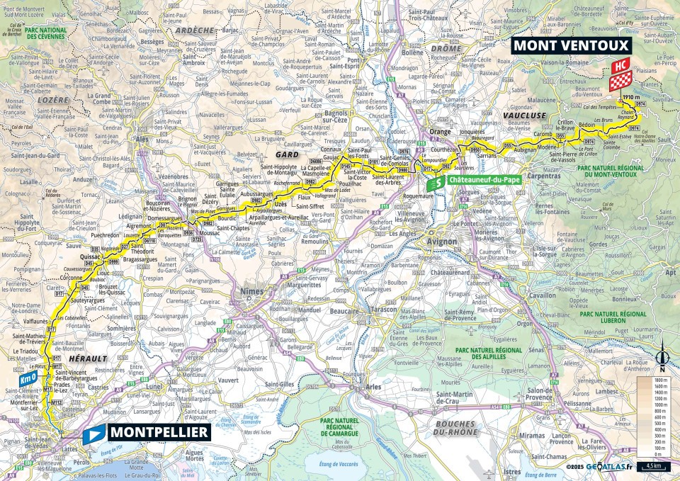
Map overview
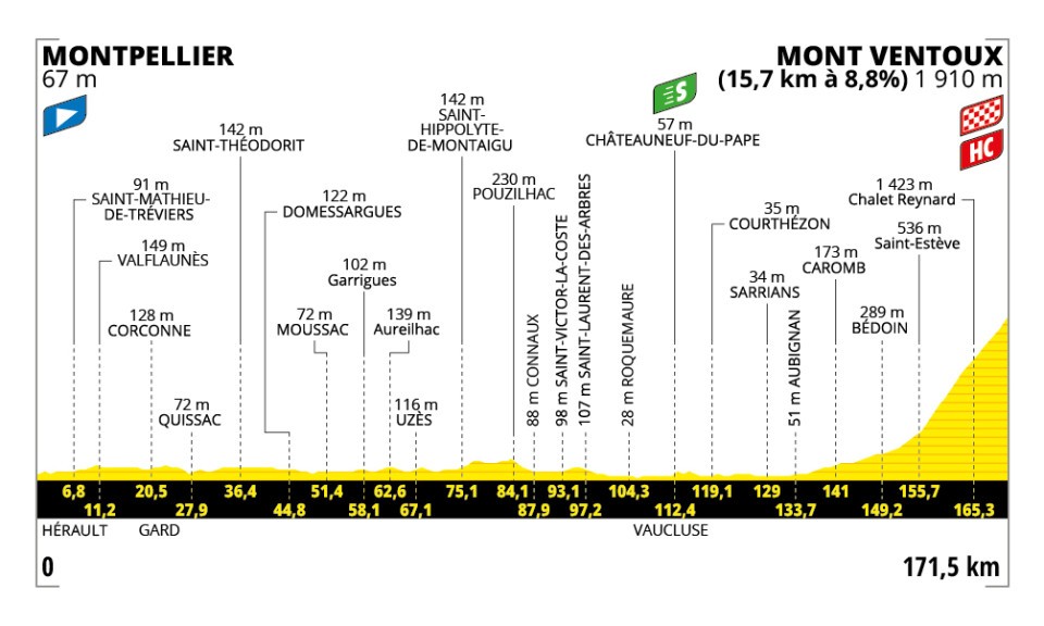
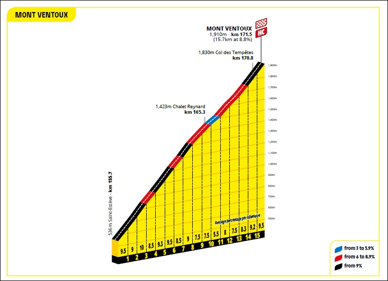
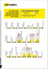
Profile overview
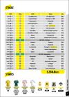
stages
roadbook (136 MB)
The stage severity (STS) is the vertical meters per kilometer of a stage [= vertical meters / kilometer]. The colors from green = flat, to red = steep, indicates the difficulty of the stage.
winner
73:54:59 - 44.7 km/h
- 01:21
t/km
Regulation
last
+5:51:40 - 41.4 km/h
- 01:27
t/km
The vertical meters for Tour de France 2025 are the average numbers of the figures published by la-flamme-rouge.eu and sanluca.cc.
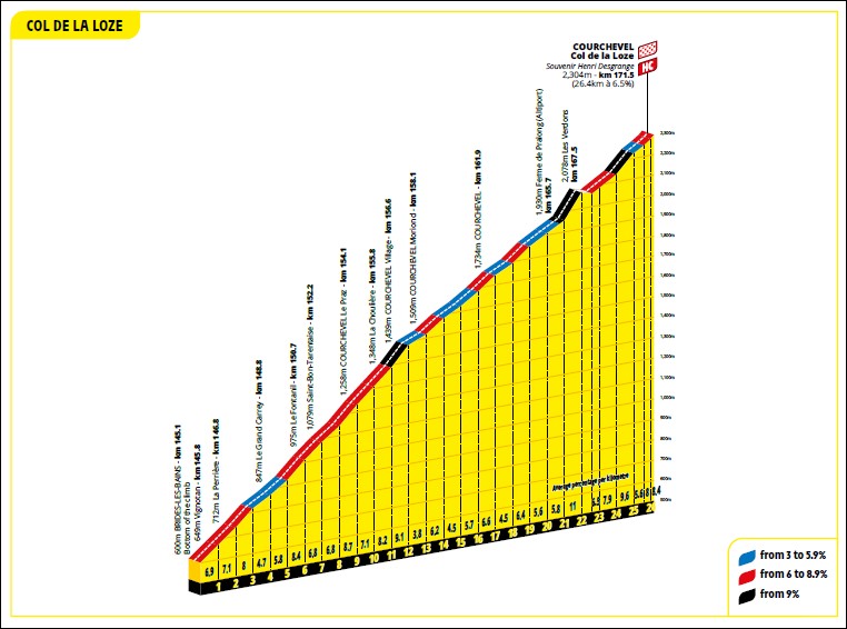
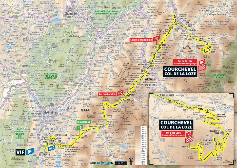
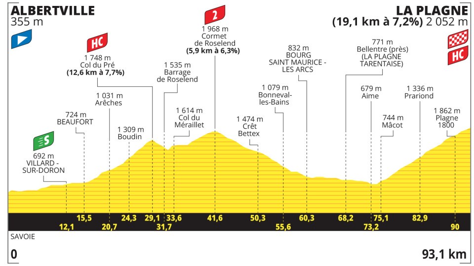
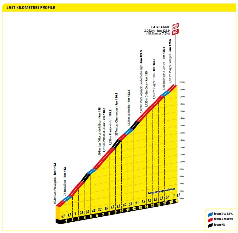
Stage 19, route changed due to an outbreak of cattle disease in the region. In consultation with the authorities, the organizers therefore decided on a shortened route without the first two climbs of the day. Original stage 130 km, 4555 m ascent, 2840 m descent, mountain classifications 2-1-HC-2-HC!
all data on this page were adjusted to the effective route taken.
№
date
km
vm
Δ
STS
category
P
L
M
IT
RP
GPS
winner
h:mm:ss
last
[m]:ss
km/h
t/km
m:ss
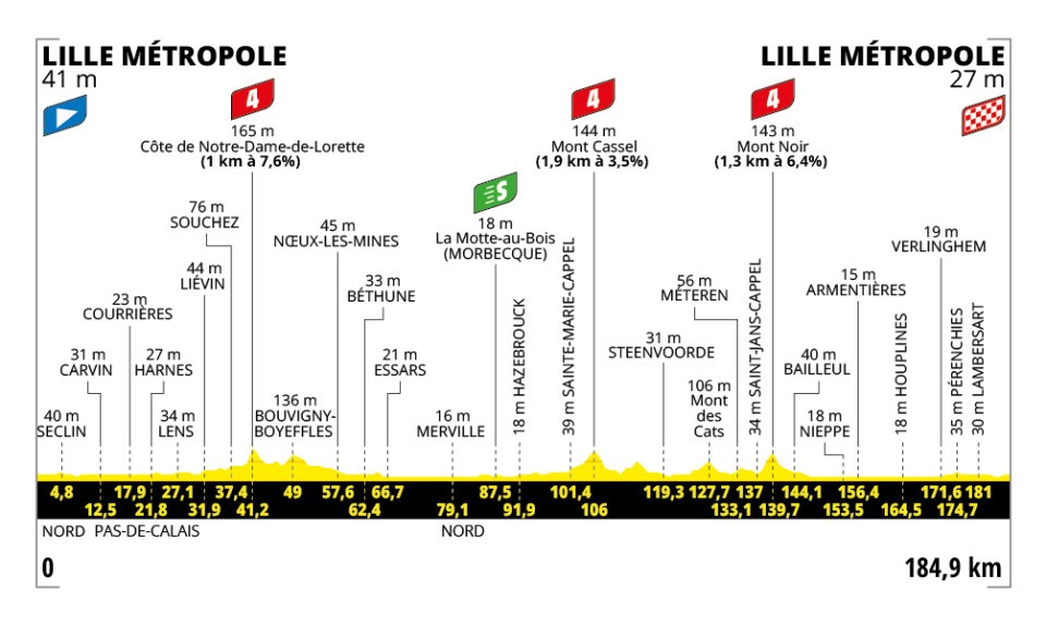
1
Sa.
5.
July
184.9
875
880
4.7
4.8
4-4-4
03:53:11
+9:11
47.6 45.8
1:16 1:19
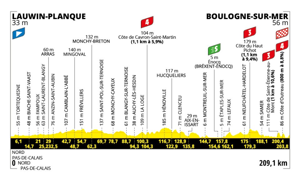
2
Su.
6.
July
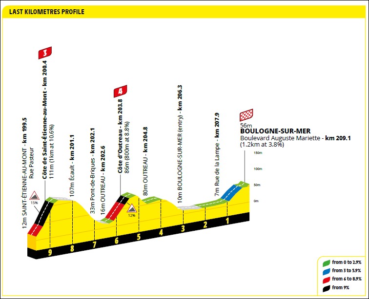
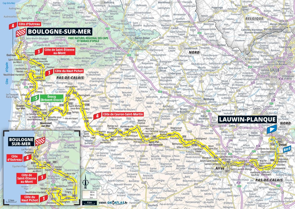
209.1
1900
1875
9.1
9.0
4-3-3-4
04:45:41
+11:16
43.9 42.2
1:22 1:25
3
Mo.
7.
July
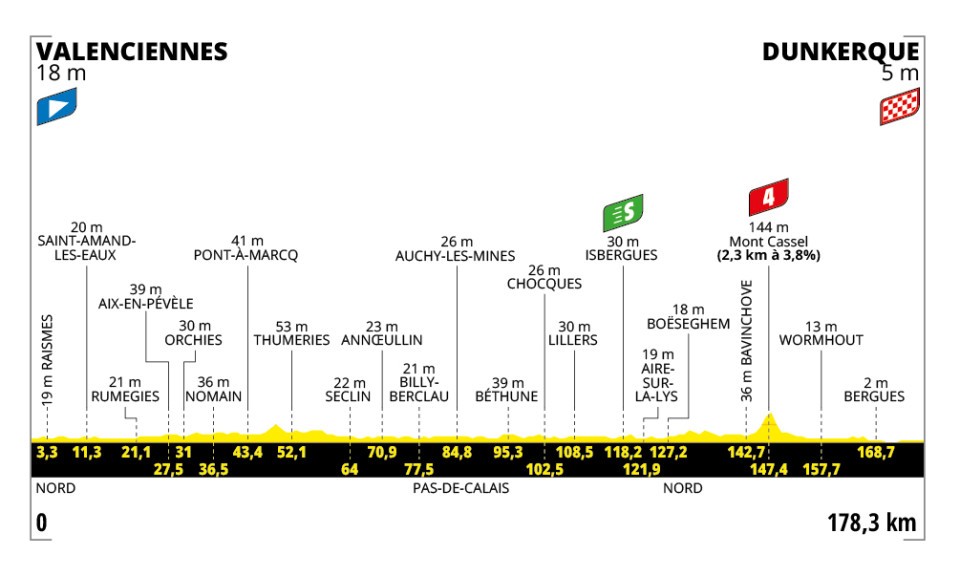
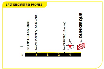
178.3
575
600
3.2
3.4
4
04:16:55
+0:00
41.6 41.6
1:26 1:26
4
Tu.
8.
July
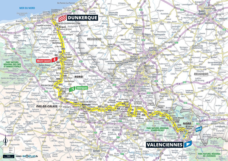
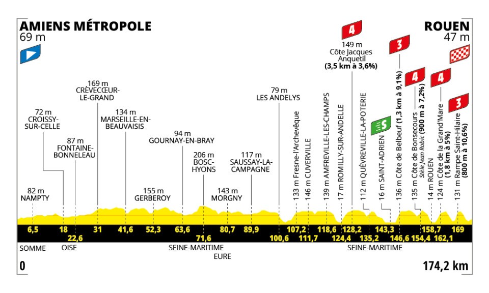
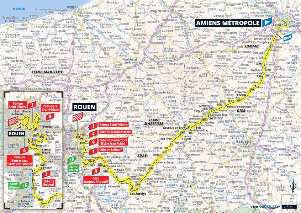
174.2
1730
1740
9.9
10.0
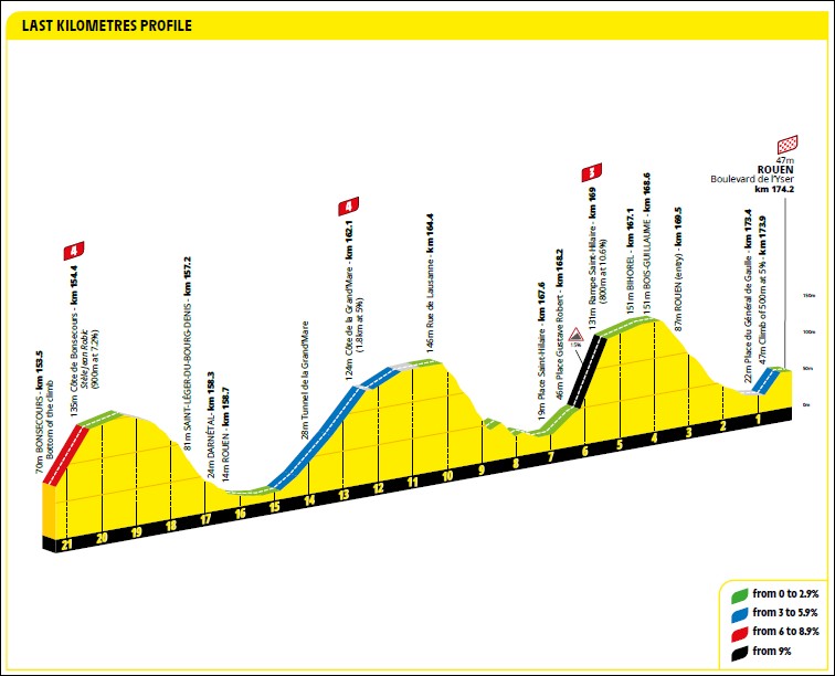
4-3-4-4-3
03:50:29
+17:44
45.3 42.1
1:19 1:25
5
We.
9.
July
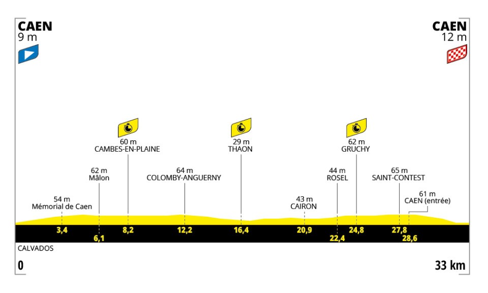
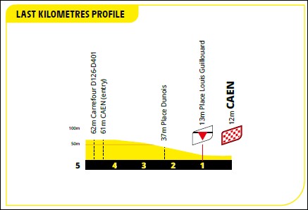
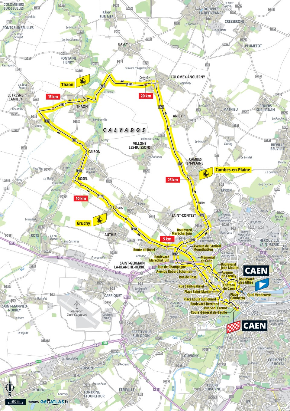
33.0
150
150
4.5
4.5
ITT
00:36:42
+6:55
54.0 45.4
1:07 1:19
6
Th.
10.
July
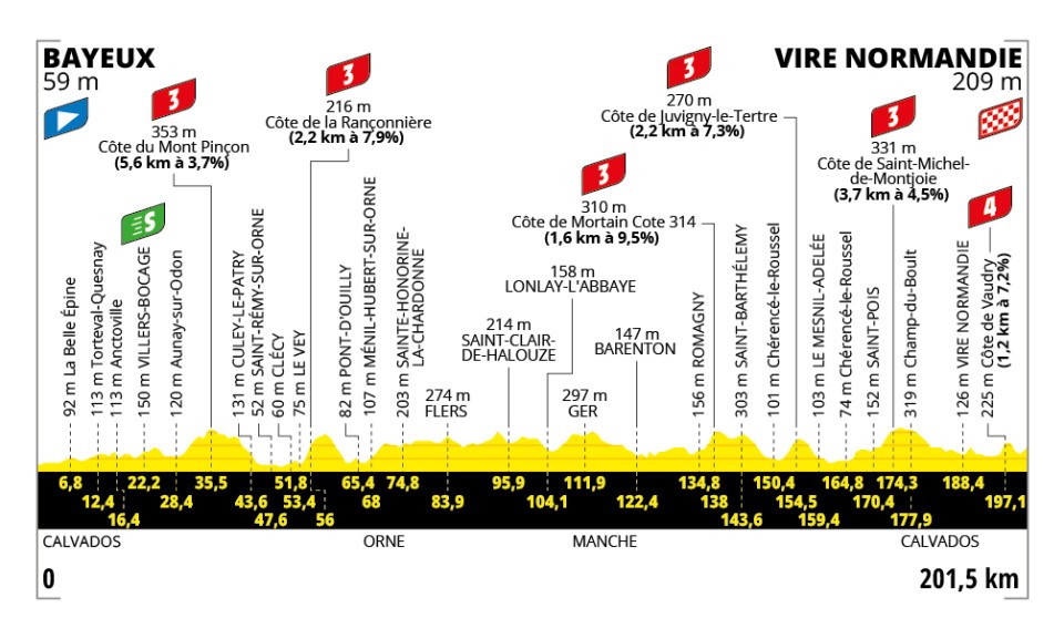
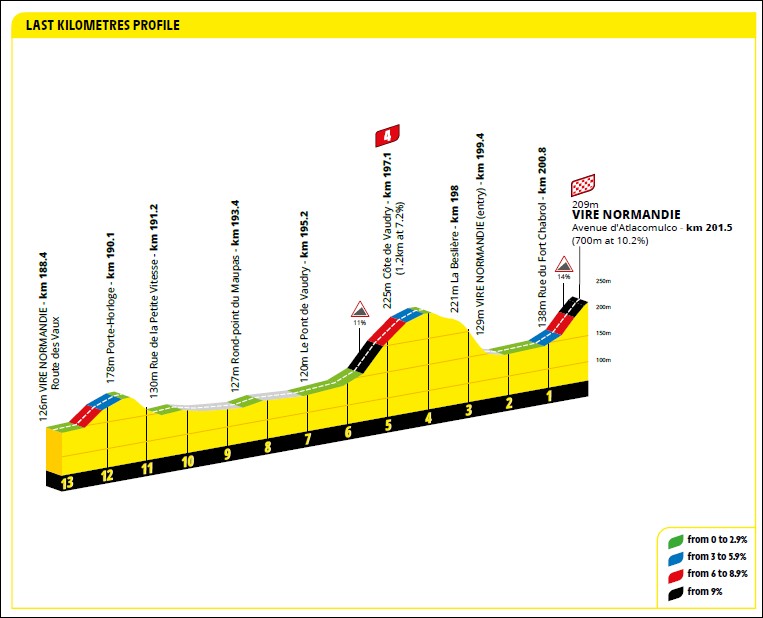
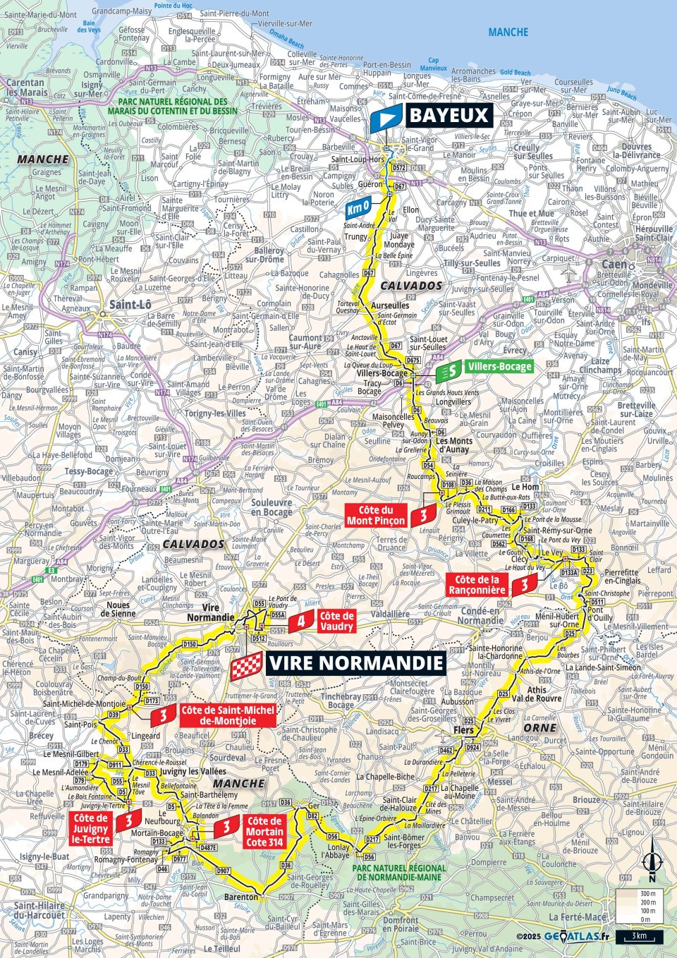
201.5
3025
2875
15.0
14.3
3-3-3-3-3-4
04:24:10
+30:15
45.8 41.1
1:19 1:28
7
Fr.
11.
July
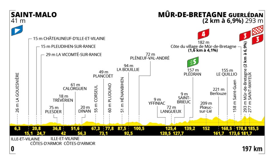
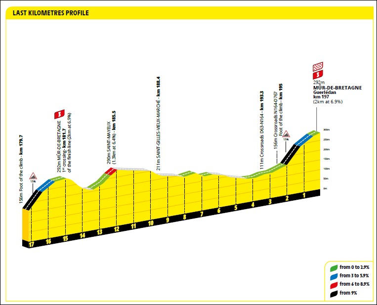
197.0
2100
1835
10.7
9.3
4-3-3!
04:05:39
+17:40
48.1 44.9
1:15 1:20
8
Sa.
12.
July
171.4
1150
1140
6.7
6.7
4
03:50:26
+13:53
44.6 42.1
1:21 1:26
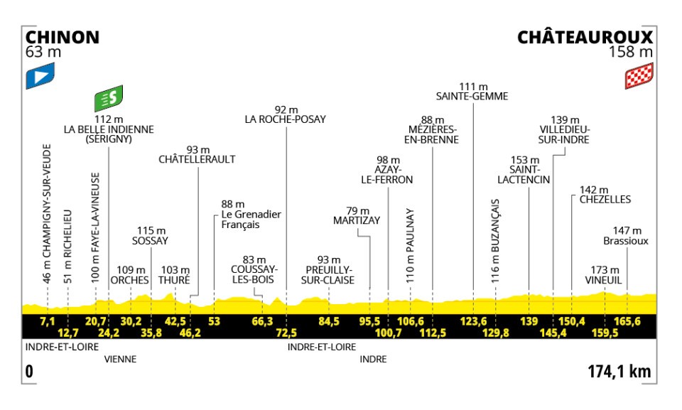
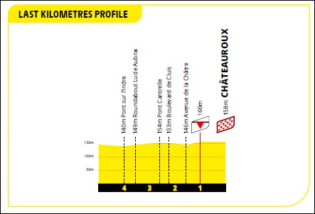
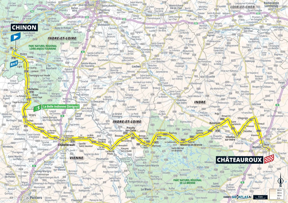
9
Su.
13.
July
174.1
915
815
5.3
4.7
03:28:52
+6:58
50.0 48.4
1:12 1:14
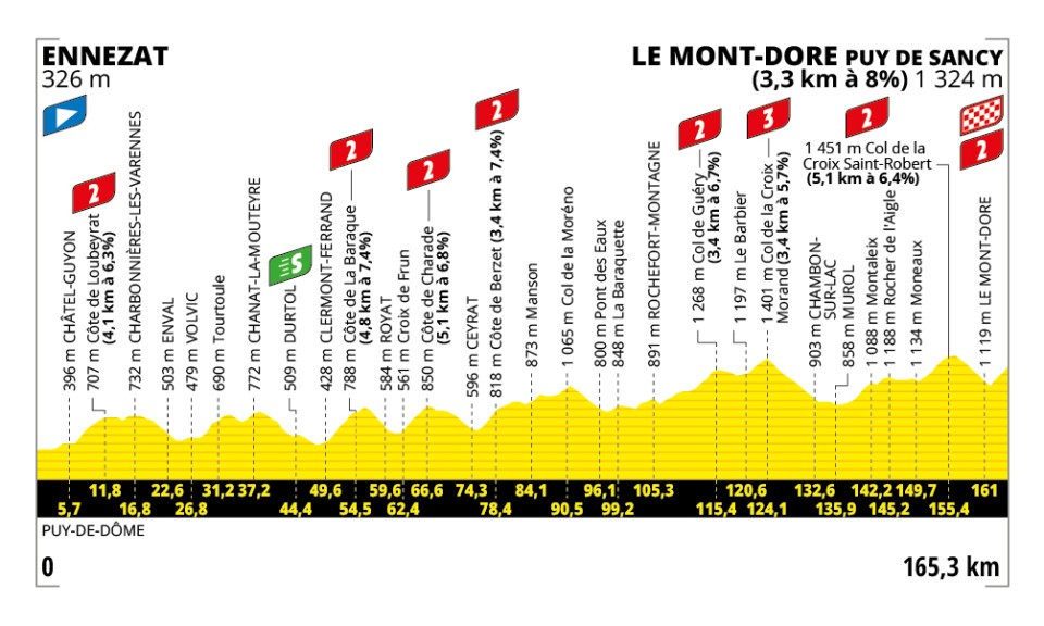
10
Mo.
14.
July
165.3
4275
3280
25.9
19.8
2-2-2-2-2-3-2-2!
04:20:05
+37:47
38.1 33.3
1:34 1:48
R
Tu.
15.
July
Rest day
11
We.
16.
July
156.8
1475
1475
9.4
9.4
4-4-4-4-3
03:15:56
+15:11
48.0 44.6
1:15 1:21
12
Th.
17.
July
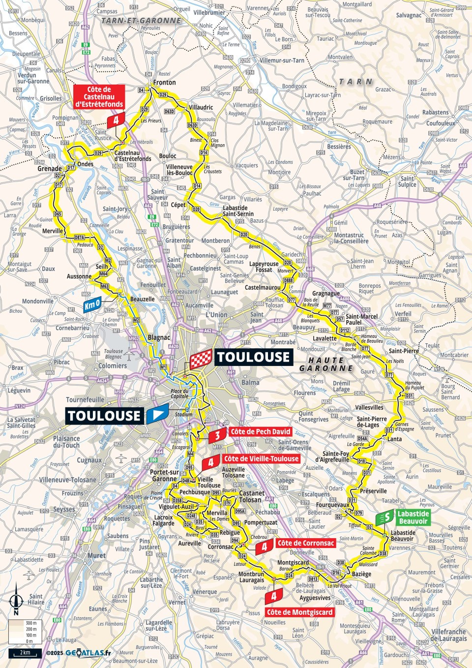
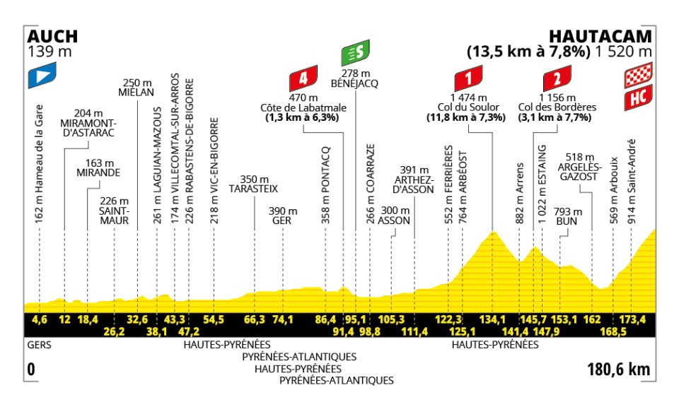
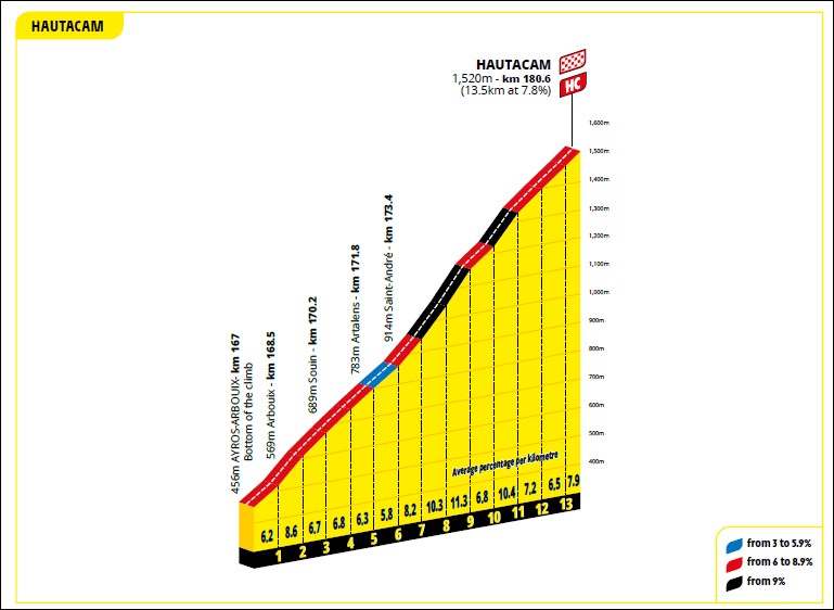
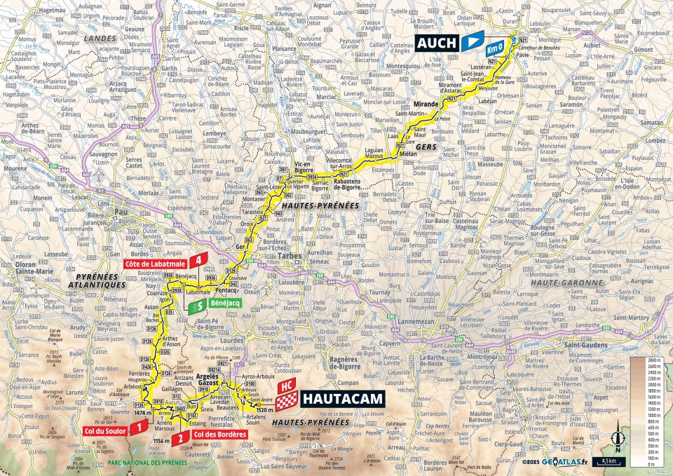
180.6
3720
2360
20.6
13.1
4-1-2-HC!
04:21:19
+44:03
41.5 35.5
1:27 1:41
13
Fr.
18.
July
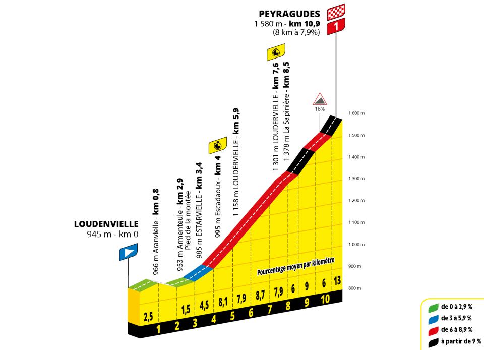
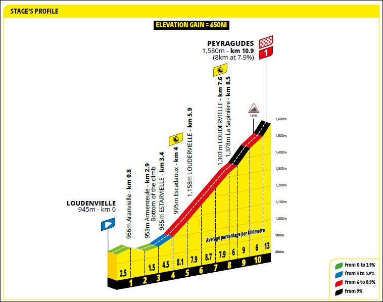
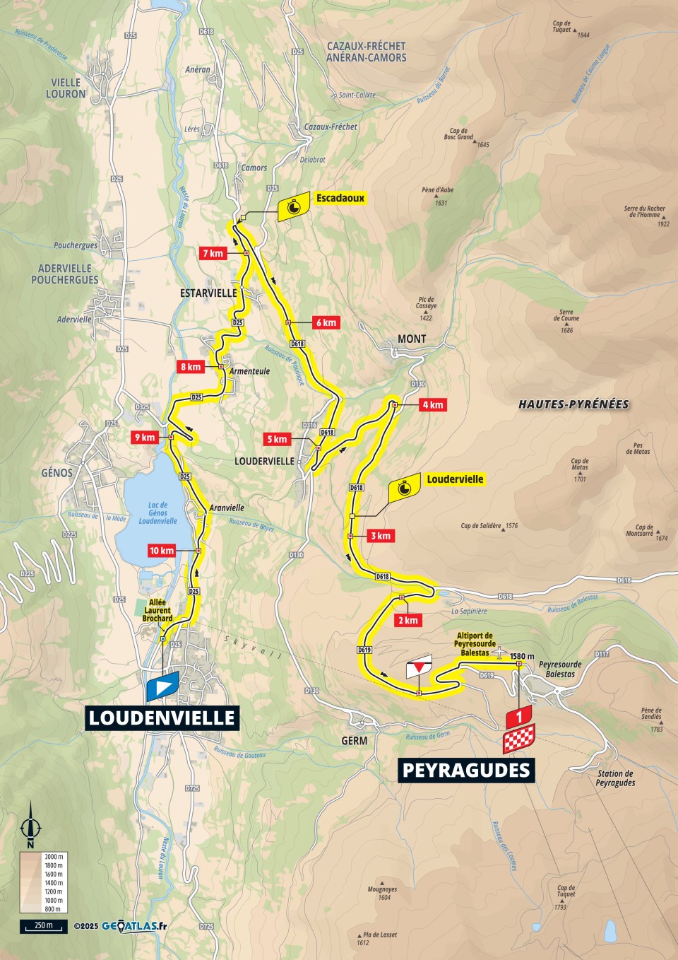
10.9
650
40
59.6
3.7
ITT-1!
00:23:00
+8:28
28.4 20.8
2:07 2:53
14
Sa.
19.
July
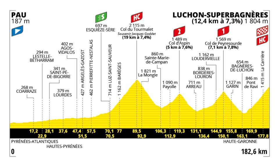
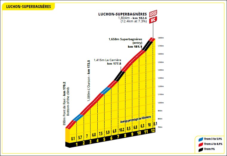
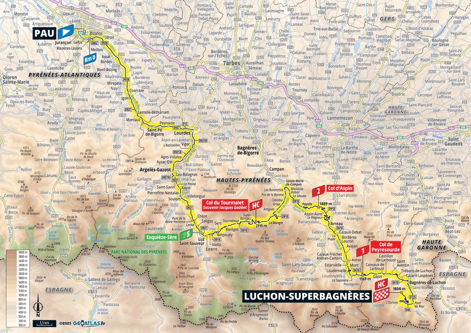
182.6
4900
3290
26.8
18.0
HC-2-1-HC!
04:53:35
+43:13
37.3 32.5
1:36 1:51
15
Su.
20.
July
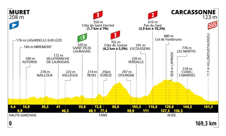
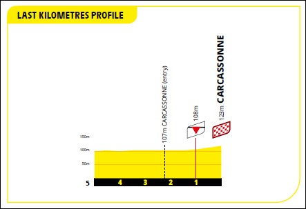
169.3
2260
2330
13.3
13.8
3-3-2
03:34:09
+22:42
47.4 42.9
1:16 1:24
R
Mo.
21.
July
Rest day
16
Tu.
22.
July
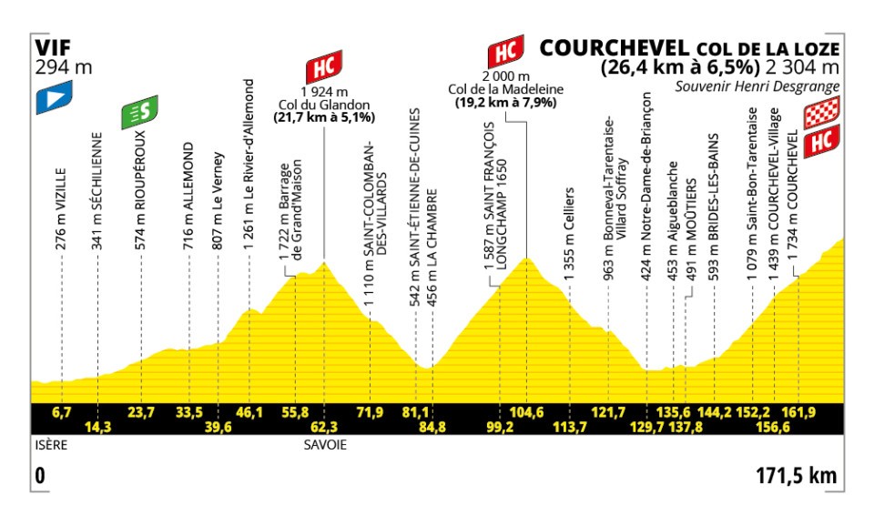
171.5
2785
935
16.2
5.5
HC!
04:03:19
+32:05
42.3 37.4
1:25 1:36
17
We.
23.
July
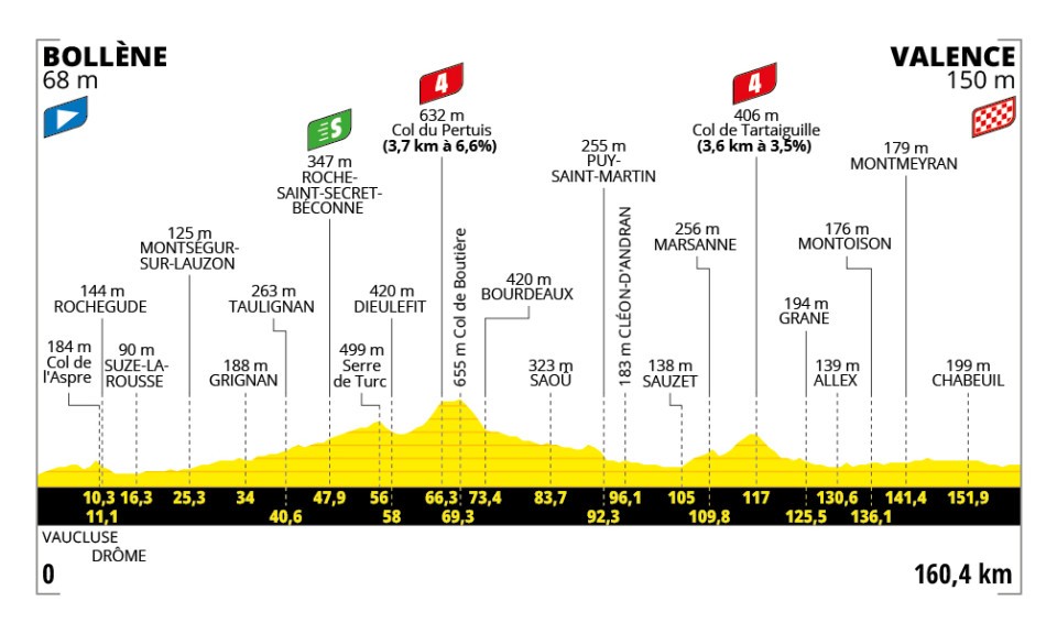
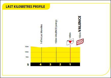
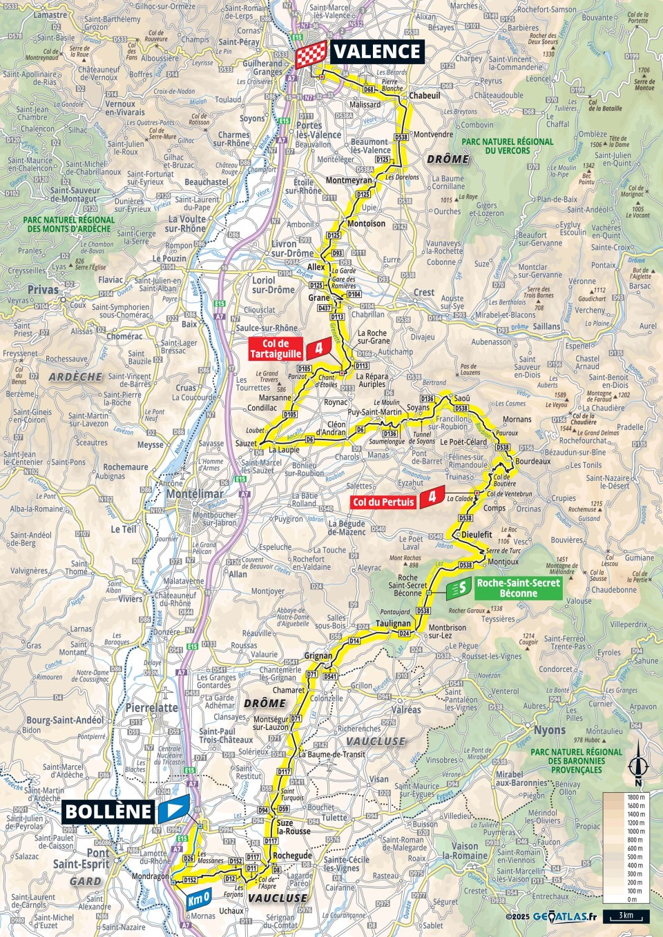
160.4
1510
1420
9.4
8.9
4-4
03:25:30
+5:24
46.8 45.6
1:17 1:19
18
Th.
24.
July
171.5
5495
3505
32.0
20.4
HC-HC-HC!
05:03:47
+46:42
33.9 29.4
1:46 2:03
19
Fr.
25.
July
93.1
3340
1680
35.9
18.0
HC-2-HC!
02:46:06
+32:02
33.6 28.2
1:47 2:08
20
Sa.
26.
July
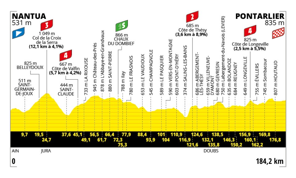
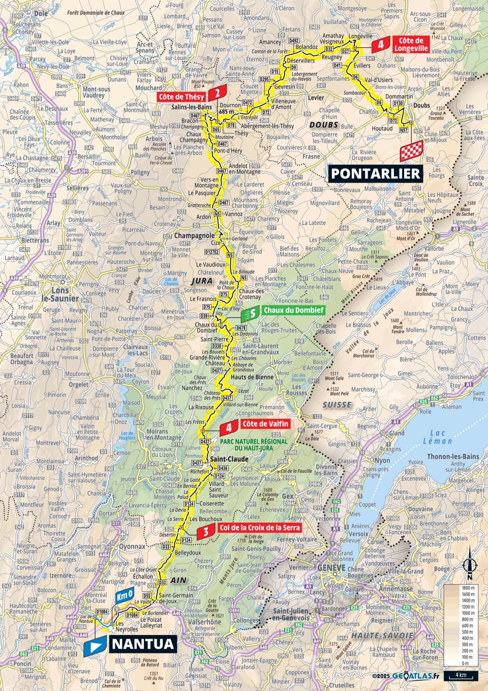
184.2
2785
2460
15.1
13.4
3-4-2-4
04:06:09
+28:49
44.9 40.2
1:20 1:30
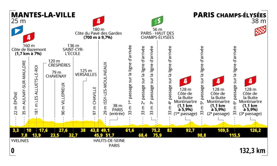
21
Su.
27.
July
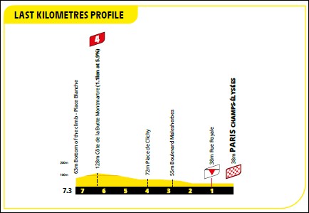
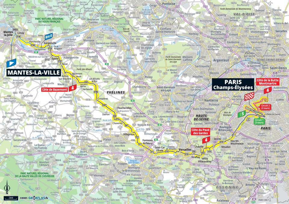
132.3
960
950
7.3
7.2
4-4-4-4-4
03:07:30
+15:17
42.3 39.1
1:25 1:32
Attention the GPS-files (gpx) are race stages and do not follow the traffic rules. The usage of the GPS-files (gpx) is on your own risk, any liability is excluded. The stages, GPS-files (gpx) were recorded with QMapShack using the information from the official organizer. The stages have been drawn most accurate as possible. Each stage starts at race km 0 and does not include neutralized kilometers. Trackpoints within tunnels were removed to eliminate incorrect vertical meters. We use the digital elevation model (copernicus.eu 1.0 DEM25) and a 5 point median filter to smooth deviation of the track points.
The radtoto.com profiles, GPS-files (gpx) and all data on the page 'stages' were created and published by radtoto.com. Copyright © by radtoto.com, all rights reserved. If you like to modify or publish files or data, ask for our approval.
Copyright © 2004 - 2026 radtoto.com. All rights reserved.
🤡🤡
Aktuell: 2 Heute: 1023 Gestern: 2878 Gesamt: 21426 Seit: 19.07.2026





 46575
46575
 35635
Δ 10940
35635
Δ 10940